1
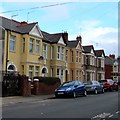
On-street parking, Bedford Road, Newport
Looking to the southeast from the corner of Harrow Road along Bedford Road towards Eton Road.
Image: © Jaggery
Taken: 11 Mar 2020
0.01 miles
2
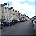
Bedford Road, Newport
These Bedford Road houses are between Harrow Road (behind the camera) and Eton Road.
Image: © Jaggery
Taken: 23 Jun 2016
0.02 miles
3
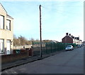
Methuen Road, Newport
Viewed from Eton Road towards Llanwern Street.
Image: © Jaggery
Taken: 28 Oct 2009
0.03 miles
4
Eton Road houses, Newport
Between Corporation Road and Rugby Road.
Image: © Jaggery
Taken: 25 Sep 2017
0.04 miles
5
Marlborough Road, Newport
From Harrow Road along Marlborough Road towards Llanwern Street and Jeffrey Street.
Image: © Jaggery
Taken: 25 Sep 2017
0.05 miles
6
Marlborough Road, Newport
Viewed from Harrow Road.
Image: © Jaggery
Taken: 28 Oct 2009
0.05 miles
7
Fire damaged houses, Marlborough Road, Newport
A fire at a joinery located behind the houses in August 2007 spread to some residences in Marlborough Road. Five houses were destroyed and another four, seen here, suffered severe fire damage. The view from the other side http://www.geograph.org.uk/photo/1561180
Image: © Jaggery
Taken: 28 Oct 2009
0.05 miles
8
Fire damage, Marlborough Road, Newport
A fire at a joinery located behind the houses in August 2007 spread to some residences in Marlborough Road. Five houses were destroyed and another four suffered severe fire damage. The area remains fenced off. View from the other side http://www.geograph.org.uk/photo/1561173
Image: © Jaggery
Taken: 28 Oct 2009
0.05 miles
9
On-street parking, Marlborough Road, Newport
Viewed from the corner of Harrow Road in March 2020.
Image: © Jaggery
Taken: 11 Mar 2020
0.05 miles
10
A gap in the houses, Marlborough Road, Newport
The fenced off area formerly contained houses. A fire in August 2007 at a joinery behind the houses spread here. Five houses were destroyed and another four suffered severe fire damage.
http://www.geograph.org.uk/photo/1561180 to a view taken in October 2009.
Image: © Jaggery
Taken: 9 Jan 2013
0.06 miles


