IMAGES TAKEN NEAR TO
St. Curigs Garden, NEWPORT, NP18 2DE
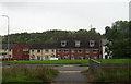
Introduction
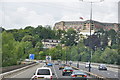
This page details the photographs taken nearby to St. Curigs Garden, NP18 2DE by members of the Geograph project.
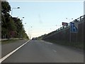
The Geograph project started in 2005 with the aim of publishing, organising and preserving representative images for every square kilometre of Great Britain, Ireland and the Isle of Man.

There are currently over 7.5m images from over14,400 individuals and you can help contribute to the project by visiting https://www.geograph.org.uk
Image Map
Images are licensed for reuse under creativecommons.org/licenses/by-sa/2.0
Notes
- Clicking on the map will re-center to the selected point.
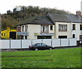
- The higher the marker number, the further away the image location is from the centre of the postcode.
Image Listing (69 Images Found)
Images are licensed for reuse under creativecommons.org/licenses/by-sa/2.0
Image
Details
Distance
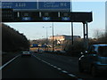
1

M4 Motorway - under the power lines east of junction 24
Image: © J Whatley
Taken: 22 Sep 2010
0.05 miles
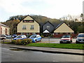
2
Farm and Stable Supplies, Langstone Cottages
The property at the eastern end of the cottages has "everything for the Farm and Equestrian market", as proclaimed on the bottom line of its name board.
The cottages are located on a short road running parallel with the southern edge of the A48 (Chepstow Road), opposite the business park roundabout.
Image: © Jaggery
Taken: 15 Nov 2009
0.05 miles
3
Newport : The M4 Motorway
The M4 Motorway heading through South Wales.
Image: © Lewis Clarke
Taken: 24 Aug 2014
0.05 miles
4
M4 Motorway - eastbound entry slip road, junction 24
Image: © J Whatley
Taken: 31 Aug 2010
0.06 miles
5

M4 Motorway - joining eastbound at junction 24
The slip road becomes a "lane gain" for the motorway, making three running lanes in all.
Image: © J Whatley
Taken: 31 Aug 2010
0.06 miles
7
War Memorial, Langstone
Recently-built War Memorial on the south side of the A48 Chepstow Road viewed in January 2018. The central part of the memorial is granite, a reference to the history of quarrying in the Langstone area. The bench on the left is dedicated to the fallen of the First World War. The bench on the right is dedicated to the fallen of the Second World War. The War Memorial was dedicated on Saturday June 3rd 2017 by the Right Reverend Richard Pain, Bishop of Monmouth.
Image: © Jaggery
Taken: 14 Jan 2018
0.09 miles
8
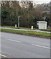
Grey cabinet, Langstone
National Grid electricity substation viewed across the A48 Chepstow Road.
Image: © Jaggery
Taken: 22 Jan 2023
0.09 miles
10
The Coldra pub and restaurant, Langstone
The Coldra pub and restaurant, McDonald's http://www.geograph.org.uk/photo/1609948 and the Premier Inn http://www.geograph.org.uk/photo/1609977 are located along a short turnoff from the A48 Chepstow Road, between the Coldra roundabout and Langstone Business Village roundabout.
Image: © Jaggery
Taken: 15 Nov 2009
0.10 miles