IMAGES TAKEN NEAR TO
Llandevaud, NEWPORT, NP18 2AD

Introduction

This page details the photographs taken nearby to NP18 2AD by members of the Geograph project.

The Geograph project started in 2005 with the aim of publishing, organising and preserving representative images for every square kilometre of Great Britain, Ireland and the Isle of Man.

There are currently over 7.5m images from over14,400 individuals and you can help contribute to the project by visiting https://www.geograph.org.uk

Image Map


Images are licensed for reuse under creativecommons.org/licenses/by-sa/2.0
Notes
  • Clicking on the map will re-center to the selected point.
  • The higher the marker number, the further away the image location is from the centre of the postcode.

Image Listing (20 Images Found)

Images are licensed for reuse under creativecommons.org/licenses/by-sa/2.0
Image
Details
Distance
1
Hillcroft, Llandevaud
House located on the northern edge of residential Llandevaud. A sign near the right edge of the view points to Church 0.4 km. Access to the church is across a trackless field.
Image: © Jaggery Taken: 25 Mar 2011
0.03 miles
2
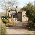
Entrance lane to The Stable Barn, Llandevaud
Viewed from the lane from the A48 to Llandevaud.
Image: © Jaggery Taken: 25 Mar 2011
0.04 miles
3
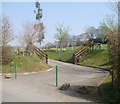
This way to St Peter's church, Llandevaud
A sign http://www.geograph.org.uk/photo/2348488 on the lane from Chepstow Road (A48) to Llandevaud directs walkers across this field on the first part of a 400-metre route to St Peter's church. http://www.geograph.org.uk/photo/2348511
Image: © Jaggery Taken: 25 Mar 2011
0.08 miles
4
Lane from Llandevaud to the A48
The view north along the narrow lane descending from Llandevaud towards Chepstow Road (A48).
Image: © Jaggery Taken: 25 Mar 2011
0.10 miles
5
Field bordering the lane from the A48 to Llandevaud
The hedge on the right is at the edge of the lane from the A48 to Llandevaud.
Image: © Jaggery Taken: 25 Mar 2011
0.10 miles
6
View from the west side of the lane to Llandevaud
Fields and gentle hills of the south Monmouthshire countryside.
Image: © Jaggery Taken: 25 Mar 2011
0.17 miles
7
Former Llandevaud School
Now a private residence, this was Llandevaud School until 1954. Located opposite the church http://www.geograph.org.uk/photo/2348511 and hall. http://www.geograph.org.uk/photo/2348526
Image: © Jaggery Taken: 25 Mar 2011
0.17 miles
8
Ordnance Survey Cut Mark
This OS cut mark can be found on the south angle of St Peter's Church. It marks a point 50.475m above mean sea level.
Image: © Adrian Dust Taken: 1 Feb 2022
0.20 miles
9
Junction of Upper and Lower Road, Llandevaud
Not just an interesting junction layout, but a pretty village green as well.
Image: © Ruth Sharville Taken: 10 Mar 2007
0.21 miles
10
The Foresters Oaks
Image: © Colin Bates Taken: 6 Feb 2006
0.21 miles