IMAGES TAKEN NEAR TO
Ponthir, NEWPORT, NP18 1HP
Introduction
This page details the photographs taken nearby to NP18 1HP by members of the Geograph project.
The Geograph project started in 2005 with the aim of publishing, organising and preserving representative images for every square kilometre of Great Britain, Ireland and the Isle of Man.

There are currently over 7.5m images from over14,400 individuals and you can help contribute to the project by visiting https://www.geograph.org.uk
Image Map
Images are licensed for reuse under creativecommons.org/licenses/by-sa/2.0
Notes
- Clicking on the map will re-center to the selected point.
- The higher the marker number, the further away the image location is from the centre of the postcode.
Image Listing (37 Images Found)
Images are licensed for reuse under creativecommons.org/licenses/by-sa/2.0
Image
Details
Distance
1
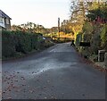
Towards Glan-y-nant
Houses at crossroads of Nantsor Road and Tre-herbert Road.
Image: © M J Roscoe
Taken: 27 Nov 2020
0.01 miles
2
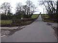
Road junction near Llandegveth
The road ahead goes to Llandegfedd Reservoir
Image: © John Lord
Taken: 9 Feb 2010
0.03 miles
3
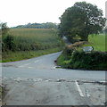
Crossroads south of Llandegveth
Nantsor Road from Llandegveth reaches Tre-herbert Road.
Turn left for Llangybi or right for the reservoir or Cwmbran.
The road ahead leads to Ponthir via Roughton.
Image: © Jaggery
Taken: 27 Sep 2011
0.06 miles
4
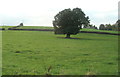
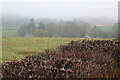
Oak in a field south of Llandegveth
Viewed from Nantsor Road.
Image: © Jaggery
Taken: 27 Sep 2011
0.09 miles
5
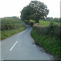
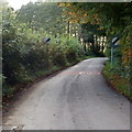
Road to Roughton and Ponthir
Viewed from crossroads http://www.geograph.org.uk/photo/3384279 south of Llandegveth.
Image: © Jaggery
Taken: 27 Sep 2011
0.09 miles
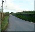
6
Tre-herbert Road heads NW away from crossroads south of Llandegveth
Tre-herbert Road heads towards Cwmbran. Viewed from crossroads. http://www.geograph.org.uk/photo/3384279
Image: © Jaggery
Taken: 27 Sep 2011
0.12 miles
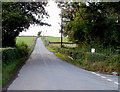
7
Tre-herbert Road heads SE away from crossroads south of Llandegveth
Viewed from crossroads. http://www.geograph.org.uk/photo/3384279
Image: © Jaggery
Taken: 27 Sep 2011
0.13 miles
8
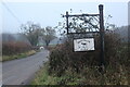
Tre-herbert Road at Pen-y-Wain Farm
Farm sign at driveway to farm Image
Image: © M J Roscoe
Taken: 27 Nov 2020
0.17 miles
9
End of the 30mph zone in Llandegveth
Nantsor Road heads SW away from Llandegveth. The 30mph speed limit
through the village increases to the National Speed Limit ahead.
Image: © Jaggery
Taken: 27 Sep 2011
0.19 miles
10
South along Nantsor Road, Llandegveth
From the Church Road and Pen y Glog Road junctions.
Image: © Jaggery
Taken: 21 Nov 2021
0.20 miles