1
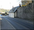
Millbrook Cottage and Millbrook House, Caerleon
Located on Mill Street.
Image: © Jaggery
Taken: 17 Apr 2010
0.02 miles
2
Castle-like wall, Caerleon
Viewed from Mill Street.
The wall was built in 1820 around some of the perimeter of the former Caerleon Castle. Only the ruins of one 13th century tower remain of the medieval stonework of the castle, which was built in the Norman period.
Image: © Jaggery
Taken: 17 Apr 2010
0.02 miles
3
Castle Motte, Caerleon
This is the only available glimpse of the motte in Caerleon as it is a private site. The wall surrounding the site was built in 1840.
Image: © Philip Halling
Taken: 11 Apr 2009
0.02 miles
4
Castle Lane, Caerleon
Viewed from the Castle Street end looking SW towards High Street.
Image: © Jaggery
Taken: 3 Jan 2014
0.04 miles
5
Listed cottages, Caerleon
Two Grade II listed cottages at 96 and 98 Mill Street, opposite Tan House Drive.
The cottages are at the southeast end of Mill Street : beyond is Castle Street.
Image: © Jaggery
Taken: 17 Apr 2010
0.05 miles
6
96 and 98 Mill Street, Caerleon
Pair of Grade II Listed early to mid 19th century Tudor Revival cottages. 96 last sold in 2013 was described as a semi-detached one bedroom cottage.
Image: © Jo and Steve Turner
Taken: 24 Jul 2022
0.05 miles
7
Ordnance Survey Cut Mark
This OS cut mark can be found on the wall at the junction of Mill Street & Cattle Lane. It marks a point 12.229m above mean sea level.
Image: © Adrian Dust
Taken: 17 Jun 2018
0.05 miles
8
Castle Lane, Caerleon
Viewed from High Street looking past the Mynde Wall towards Mill Street. https://www.geograph.org.uk/photo/5950251 to the plaque on the wall.
Image: © Jaggery
Taken: 24 Aug 2018
0.06 miles
9
Boddington Terrace, Caerleon
Row of brick houses viewed from the corner of Backhall Street.
A street name sign near the camera shows that
Boddington Terrace leads to Cross Street and Camelot Court.
Image: © Jaggery
Taken: 1 Nov 2018
0.06 miles
10
Myrtle Cottages, Caerleon
Looking towards Mill Street.
Before 1939, this area was a pasture field. In spring 1939, before house building began, the site was excavated. It had been part of the Roman legionary fortress of Isca Silurum from about 75AD to 300AD. Among the discoveries were remmants of barrack buildings, and five gold coins dating from 55AD-74 AD. These coins were believed to have been lost or hidden in the first few years of the Roman occupation.
Image: © Jaggery
Taken: 28 Feb 2010
0.06 miles


