IMAGES TAKEN NEAR TO
Sedbury, CHEPSTOW, NP16 7EX
Introduction
This page details the photographs taken nearby to NP16 7EX by members of the Geograph project.
The Geograph project started in 2005 with the aim of publishing, organising and preserving representative images for every square kilometre of Great Britain, Ireland and the Isle of Man.

There are currently over 7.5m images from over14,400 individuals and you can help contribute to the project by visiting https://www.geograph.org.uk
Image Map
Images are licensed for reuse under creativecommons.org/licenses/by-sa/2.0
Notes
- Clicking on the map will re-center to the selected point.
- The higher the marker number, the further away the image location is from the centre of the postcode.
Image Listing (41 Images Found)
Images are licensed for reuse under creativecommons.org/licenses/by-sa/2.0
Image
Details
Distance
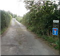
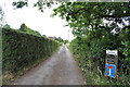
1
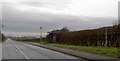
Bus stop on Buttington Hill
The first Severn crossing is just visible in the background.
Image: © Steve Fareham
Taken: 28 Jan 2009
0.04 miles
3
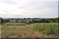
Looking down towards Pennsylvania village
Image: © Nick Mutton 01329 000000
Taken: 29 Jun 2010
0.04 miles
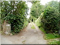
4
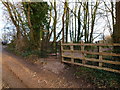
Gate on Offa's Dyke Path at Buttington Tump, Sedbury
Image: © Ruth Sharville
Taken: 8 Jan 2012
0.04 miles
6
Buttington Terrace, Beachley
Viewed from the meeting point of Buttington Hill and Beachley Road. There are six houses further along Buttington Terrace. Above the No Through Road sign on the right, another sign states that this a private road (public footpath only).
Image: © Jaggery
Taken: 17 Sep 2010
0.07 miles
7
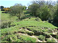
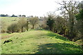
Offa's Dyke earthworks at Sedbury Cliffs
Thispicture shows the remains of the earthworks of Offa's Dyke, constructed by the Mercian King Offa towards the end of the 8th Century to keep the Welsh safely in Wales. The dyke was constructed some way into English territory, as his workers obviously needed to be able to gain access to both sides of the dyke without being assailed by spears and arrows and other primitive - but - unpleasant artillery. Some formerly English villages were forcibly relocated into Wales because of the route of the dyke, which must have been rather hard on the locals. At the very least, it would have meant their children wouldn't have always been able to get into their choice of school, although this was probably less of an issue than potentially being chopped into catfood by hostile Welshmen.
Image: © John Winder
Taken: 13 Apr 2009
0.07 miles
8
Looking down Buttington Terrace
Image: © Nick Mutton 01329 000000
Taken: 10 Jul 2010
0.08 miles
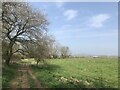
9
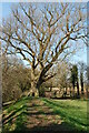
Sedbury : track from Buttington Hill to houses
A track heads away SW from Buttington Hill, in the direction of houses at the southern edge of residential Sedbury.
Image: © Jaggery
Taken: 17 Sep 2010
0.09 miles