1
Footpaths on Chepstow Old Hill
This is where the Gloucestershire Way and the Offa's Dyke Long Distance footpaths converge. Up the hill, the footpaths cross the road into Mopla Road, where there is a kissing gate on the left where the two paths diverge :
Image
From the right, comes the Offa's Dyke footpath from Tutshill, Sedbury, and the Severn Estuary :
Image
Behind the camera is Chepstow bridge, one end of the Gloucestershire Way :
Image and
Image
Image: © Roy Parkhouse
Taken: 11 Aug 2007
0.02 miles
2
Offa's Dyke footpath signpost
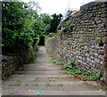
Halfway down the hill the path turns left
Image
Image: © Roy Parkhouse
Taken: 11 Aug 2007
0.03 miles
3
Old Hill from Chepstow bridge
From "Turnpike Roads" by Ivor Waters (ISBN 0906134315) : "In 1808 the New Road round Castleford was built, and the coaches and carriages were at last freed from the tyranny of the Old Hill".
The sign post on the right is for the Gloucestershire Way Long Distance Path.
See also
Image
Image: © Roy Parkhouse
Taken: 11 Nov 2002
0.05 miles
4
View down Chepstow Old Hill
Image: © Roy Parkhouse
Taken: 11 Aug 2007
0.05 miles
5
White marquee below Castleford Hill, Tutshill
In the grounds of St John's-On-The-Hill School viewed on July 7th 2016.
Image: © Jaggery
Taken: 7 Jul 2016
0.05 miles
6
A walk around the east bank of the River Wye [5]
Wyecliffe House, The Old Hill, was built in the late 18th or early 19th century. Constructed, in a 'T' shape plan, of rendered brick, lined to simulate ashlar, under a slate roof. Listed, grade II, with details at: https://historicengland.org.uk/listing/the-list/list-entry/1100620
The walk leaves Chepstow, crosses the River Wye, and ascends through Tutshill, following the long distance Offa’s Dyke Path. A diversion down the Lancaut Walk is taken before returning to rejoin Offa’s Dyke Path to Wintour’s Leap. After crossing Coleford Road, B4228, footpaths and roads are taken through Woodcroft and Tutshill to recross the river and return to the starting point. About 5 miles.
Image: © Michael Dibb
Taken: 3 Sep 2022
0.06 miles
7
St John's Hill, Chepstow
Image: © Nick Mutton 01329 000000
Taken: 18 Apr 2010
0.06 miles
8
A walk around the east bank of the River Wye [6]
Bridge End Cottage, The Old Hill, is linked to Wyecliffe House
Image Built in the late 18th century of rendered rubble stone under a slate roof. Listed, grade II, with details at: https://historicengland.org.uk/listing/the-list/list-entry/1186664
The walk leaves Chepstow, crosses the River Wye, and ascends through Tutshill, following the long distance Offa’s Dyke Path. A diversion down the Lancaut Walk is taken before returning to rejoin Offa’s Dyke Path to Wintour’s Leap. After crossing Coleford Road, B4228, footpaths and roads are taken through Woodcroft and Tutshill to recross the river and return to the starting point. About 5 miles.
Image: © Michael Dibb
Taken: 3 Sep 2022
0.06 miles
9
South along Offa's Dyke Path, Tutshill
Steps down from the south side of Castleford Hill lead to a footpath to the southeast part of Castleford Hill on the approach to the old bridge over the River Wye to Chepstow. This footpath route, part of Offa's Dyke Path, is about 250 metres long whereas the route by road to the same location is about 600 metres.
Image: © Jaggery
Taken: 7 Jul 2016
0.07 miles
10
The Old Road Bridge across the River Wye, Chepstow
Viewed from the Welsh side looking towards Gloucestershire and England. The national boundary is the midpoint between the banks. The Wye here is tidal, fed by water from the Bristol Channel via the River Severn. The tidal range is the second highest in the world, after the Bay of Fundy in Canada. Any bridge across the Wye here needs to be tall and strong enough to resist the frequent reversals in the flow of water. The earliest known bridge across the river in this area was a Roman one about a kilometre upstream. This elegant cast-iron bridge dates from 1816. Its predecessors in this location were a wooden bridge of c1700 and its late 18th century wood and stone successor.
Image: © Jaggery
Taken: 13 Nov 2012
0.07 miles


![A walk around the east bank of the River Wye [5]](https://s1.geograph.org.uk/geophotos/07/36/20/7362057_49b6e4c8_120x120.jpg)

![A walk around the east bank of the River Wye [6]](https://s0.geograph.org.uk/geophotos/07/36/20/7362064_3926d9ee_120x120.jpg)

