IMAGES TAKEN NEAR TO
Tintern, CHEPSTOW, NP16 6TH

Introduction

This page details the photographs taken nearby to NP16 6TH by members of the Geograph project.

The Geograph project started in 2005 with the aim of publishing, organising and preserving representative images for every square kilometre of Great Britain, Ireland and the Isle of Man.

There are currently over 7.5m images from over14,400 individuals and you can help contribute to the project by visiting https://www.geograph.org.uk

Image Map


Images are licensed for reuse under creativecommons.org/licenses/by-sa/2.0
Notes
  • Clicking on the map will re-center to the selected point.
  • The higher the marker number, the further away the image location is from the centre of the postcode.

Image Listing (29 Images Found)

Images are licensed for reuse under creativecommons.org/licenses/by-sa/2.0
  • ...
Image
Details
Distance
1
Row of recently-built houses in the Angiddy Valley near Tintern
Row of 4 houses built in the first decade of the 21st century.
Image: © Jaggery Taken: 19 Jan 2014
0.03 miles
2
Postbox in the Angiddy Valley near Tintern
The red postbox on a wooden post is near these http://www.geograph.org.uk/photo/3986231 recently-built houses.
Image: © Jaggery Taken: 19 Jan 2014
0.05 miles
3
Path to Lower Hale Wood near Tintern
The path climbs away from the Angiddy Valley towards Lower Hale Wood on Barbadoes Hill.
Image: © Jaggery Taken: 19 Jan 2014
0.07 miles
4
The Cherry Tree Inn
A deservedly popular boozer up the narrow lane to the west of Tintern.
Image: © Jonathan Billinger Taken: 28 Dec 2006
0.09 miles
5
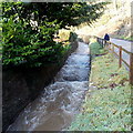
Angiddy about 650 metres from the Wye in Tintern
Some references call the Angiddy a stream, others a river. Whichever it is, this view of a vigorous tributary of the River Wye in mid January 2014 is probably typical of its appearance during much of the very wet winter of 2013-2014.
Image: © Jaggery Taken: 19 Jan 2014
0.11 miles
6
Crown Cottages in the Angiddy Valley near Tintern
Semi-detached cottages alongside Angiddy Brook. A royal crest and the year 1904 are on the wall.
Image: © Jaggery Taken: 19 Jan 2014
0.11 miles
7
Cherry Tree Inn, Tintern
Located in the Angiddy Valley, viewed in January 2014. The Friends of the Cherry Tree website reports that the current owners abandoned the inn on December 6th 2010 and moved to another pub a few miles away. An application to Monmouthshire County Council for 'Change of use from public house and alterations to form two dwellings' was submitted on April 28th 2011. The future of the Cherry Tree is uncertain...
Image: © Jaggery Taken: 19 Jan 2014
0.11 miles
8
Road junction in the Angiddy Valley, Tintern
The road on the left is unsuitable for heavy goods vehicles.
Image: © Jaggery Taken: 19 Jan 2014
0.12 miles
9
Across Barbadoes Hill
A track descends across steep ground towards Tintern.
Image: © Richard Webb Taken: 6 May 2012
0.12 miles
10
Path, Tintern
A descent across steep ground into Tintern.
Image: © Richard Webb Taken: 6 May 2012
0.14 miles
  • ...