IMAGES TAKEN NEAR TO
Tudor Gardens, CHEPSTOW, NP16 6SS

Introduction

This page details the photographs taken nearby to Tudor Gardens, NP16 6SS by members of the Geograph project.

The Geograph project started in 2005 with the aim of publishing, organising and preserving representative images for every square kilometre of Great Britain, Ireland and the Isle of Man.

There are currently over 7.5m images from over14,400 individuals and you can help contribute to the project by visiting https://www.geograph.org.uk

Image Map


Images are licensed for reuse under creativecommons.org/licenses/by-sa/2.0
Notes
  • Clicking on the map will re-center to the selected point.
  • The higher the marker number, the further away the image location is from the centre of the postcode.

Image Listing (66 Images Found)

Images are licensed for reuse under creativecommons.org/licenses/by-sa/2.0
  • ...
Image
Details
Distance
1
Coal Road, Devauden
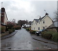
Looking east along Coal Road, not a through route for motor vehicles. Walkers and cyclists can go this way for Lower Fedw.
Image: © Jaggery Taken: 13 Jan 2014
0.07 miles
2
The Masons Arms
A village pub in the wooded hills west of Chepstow.
Image: © Jonathan Billinger Taken: 27 Dec 2006
0.07 miles
3
Devauden
The road turns into a green lane and then path to the top of a small hill.
Image: © Richard Webb Taken: 21 Mar 2022
0.08 miles
4
Towards The Smithy, Devauden
The street ahead is unnamed (the houses are named). The left turn is into a street named The Smithy.
Image: © Jaggery Taken: 13 Jan 2014
0.08 miles
5
Former pub in Devauden
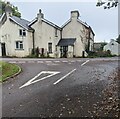
Formerly the Masons Arms pub opposite the village green. In September 2021, the What Pub website states "This pub is permanently closed".
Image: © Jaggery Taken: 26 Sep 2021
0.08 miles
6
Unclassified road in Devauden
Looking to the SE away from the village green.
Image: © Jaggery Taken: 26 Sep 2021
0.08 miles
7
Former Masons Arms pub, Devauden
Viewed across Coal Road. The village has had no pub since the closure of the Masons Arms, now a private residence.
Image: © Jaggery Taken: 13 Jan 2014
0.08 miles
8
Closed public house, Devauden
An all too common sight these days, a closed pub. This was the Masons Arms in Devauden and it closed in the autumn of 2011. It was photographed six months earlier in the spring Image
Image: © Philip Halling Taken: 20 Oct 2012
0.08 miles
9
Road from Devauden to Fedw
Looking SE from the corner of Coal Road http://www.geograph.org.uk/photo/3813233 in Devauden.
Image: © Jaggery Taken: 13 Jan 2014
0.08 miles
10
The Mason's Arms, Devauden
The village pub, dating from around 1800.
Image: © Eirian Evans Taken: 30 Apr 2011
0.08 miles
  • ...