IMAGES TAKEN NEAR TO
Usk Road, CHEPSTOW, NP16 6SL

Introduction

This page details the photographs taken nearby to Usk Road, NP16 6SL by members of the Geograph project.

The Geograph project started in 2005 with the aim of publishing, organising and preserving representative images for every square kilometre of Great Britain, Ireland and the Isle of Man.

There are currently over 7.5m images from over14,400 individuals and you can help contribute to the project by visiting https://www.geograph.org.uk

Image Map


Images are licensed for reuse under creativecommons.org/licenses/by-sa/2.0
Notes
  • Clicking on the map will re-center to the selected point.
  • The higher the marker number, the further away the image location is from the centre of the postcode.

Image Listing (8 Images Found)

Images are licensed for reuse under creativecommons.org/licenses/by-sa/2.0
Image
Details
Distance
1
A very muddy layby
On the B4235
Image: © Jonathan Billinger Taken: 28 Dec 2006
0.09 miles
2
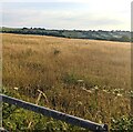
View from a field gate near Earlswood, Monmouthshire
Viewed from this https://www.geograph.org.uk/photo/7230566 overgrown gate in July 2022.
Image: © Jaggery Taken: 17 Jul 2022
0.14 miles
3
Sheep in a field at Earlswood Common
Image: © Philip Halling Taken: 27 Sep 2021
0.15 miles
4
Overgrown field gate near Earlswood
The weeds growing on and near the gate in July 2022 show that the gate has not been used recently.
Image: © Jaggery Taken: 17 Jul 2022
0.20 miles
5
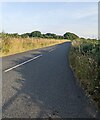
Road between Earlswood and Gaerllwyd, Monmouthshire
Ahead for Gaerllwyd. Behind the camera for Earlswood.
Image: © Jaggery Taken: 17 Jul 2022
0.20 miles
6
B4235 west of Bullyhole Bottom
Image: © Colin Pyle Taken: 21 Apr 2018
0.20 miles
7
Rural Monmouthshire in late March 2018
Viewed from a field gate in Gaerllwyd on March 25th 2018.
Image: © Jaggery Taken: 25 Mar 2018
0.21 miles
8
Road between Gaerllwyd and Earlswood, Monmouthshire
Ahead for Earlswood. Behind the camera for Gaerllwyd.
Image: © Jaggery Taken: 17 Jul 2022
0.22 miles