1
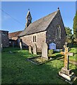
House and church, Trelleck Grange
Trelleck Grange church and a cottage viewed from the south.
Image: © Philip Halling
Taken: 10 Dec 2011
0.02 miles
2
Church at Trelleck Grange
The church at Trelleck Grange was formerly a chapel serving the farm or grange which was part of the land holdings of the Cistercian Abbey at Tintern. The site is thought to be of Roman or Early Christian origins and may have been a Celtic monastery before its gift to the abbey. The church was substantially rebuilt in 1861.
Image: © Andy Stott
Taken: 8 Apr 2015
0.02 miles
3
Trelleck Grange church
Trelleck Grange church appears to have no known dedication and was rebuilt in 1861 on its original foundations.
Image: © Philip Halling
Taken: 10 Dec 2011
0.02 miles
4
Plaque on Millennium Stone
Plaque on Millennium Stone in Treeleck Grange. See:
Image]
Image: © Philip Halling
Taken: 10 Dec 2011
0.03 miles
5
Millennium standing stone, Trelleck Grange
With echoes of our Celtic past this standing stone was placed here by the Trelleck Grange community near the entrance to Trelleck Grange church to mark the Millennium. Below it a time capsule was placed to be opened in 2200. See:
Image]
Image: © Philip Halling
Taken: 10 Dec 2011
0.03 miles
6
Churchyard path, Trelleck Grange, Monmouthshire
Towards Trelleck Grange Church https://www.geograph.org.uk/photo/7340029 in the Church in Wales Diocese of Monmouth.
Image: © Jaggery
Taken: 13 Nov 2022
0.03 miles
7
Grade II Listed Trelleck Grange Church, Monmouthshire
In the Church in Wales Diocese of Monmouth. Chapel Farm buildings are on the left. Cadw records that Trelleck Grange is a pre-Norman site, later a monastic site belonging to Tintern Abbey. The present church is medieval in origin but undatable because all the features other than the door are from the 1861 restoration. It has not been changed since then apart from the addition of heating and lighting. The estate passed to the Somersets (later Dukes of Beaufort) at the Dissolution. They continued to hold it until 1873. The register begins in 1770. There is no tithe map as the parish was wholly owned by the Duke.
Grade II Listed in 2000 as a small medieval church virtually unchanged since its 1861 restoration.
Image: © Jaggery
Taken: 13 Nov 2022
0.03 miles
8
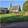
Church and farm buildings, Trelleck Grange, Monmouthshire
Trelleck Grange Church in the Church in Wales Diocese of Monmouth is on the right.
Image: © Jaggery
Taken: 13 Nov 2022
0.03 miles
9
Church at Trelleck Grange
Image: © Ruth Sharville
Taken: 16 Jan 2015
0.03 miles
10
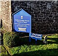
Information board, Trelleck Grange Church, Monmouthshire
In November 2022 the board located here https://www.geograph.org.uk/photo/7340029 shows
"Services held on 1st & 3rd Sundays of the month at 11am.
Also on festival occasions".
The adjacent small sign shows "CAUTION Uneven Surfaces".
Image: © Jaggery
Taken: 13 Nov 2022
0.04 miles


