1
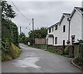
Wayne Close, Llanishen
Viewed from Church Road.
Image: © Jaggery
Taken: 4 Mar 2012
0.02 miles
2
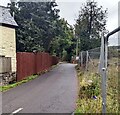
Old Coach House, Llanishen, Monmouthshire
Alongside an unnamed road leading to Wayne Close and the B4293 near the Carpenters Arms pub.
Image: © Jaggery
Taken: 4 Sep 2022
0.04 miles
3
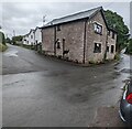
Church Road houses in Llanishen
Llanishen is a village in eastern Monmouthshire, about 8 miles from Monmouth and 7 from Chepstow.
Image: © Jaggery
Taken: 4 Mar 2012
0.04 miles
4
SE along Church Road, Llanishen, Monmouthshire
Ahead for the B4293. Behind the camera for the Village Hall and St Dennis Church.
Image: © Jaggery
Taken: 4 Sep 2022
0.05 miles
5
Yellow Diverted Traffic sign, Church Road, Llanishen, Monmouthshire
In September 2022 the sign shows the Welsh "Traffig y gwyriad" above "Diverted Traffic".
Image: © Jaggery
Taken: 4 Sep 2022
0.05 miles
6
Minor road, Llanishen, Monmouthshire
Ahead for the village hall and St Dennis Church.
Behind the camera for the B4293 and the Carpenters Arms. https://www.geograph.org.uk/photo/7272823
Image: © Jaggery
Taken: 4 Sep 2022
0.05 miles
7
Yellow and red, Llanishen, Monmouthshire
In September 2022 a yellow salt / grit bin and a red bin for dog waste are alongside the access road from Church Road to the Village Hall. https://www.geograph.org.uk/photo/7273776
Image: © Jaggery
Taken: 4 Sep 2022
0.06 miles
8
A corner house in Llanishen, Monmouthshire
Church Road on the right leads to the B4293.
Image: © Jaggery
Taken: 4 Sep 2022
0.06 miles
9
Dark green tank, Llanishen, Monmouthshire
In September 2022 a label on the tank located between a children's playground and Church Road shows KEROSENE (BURNING OIL)
Image: © Jaggery
Taken: 4 Sep 2022
0.06 miles
10
Road past the village pub towards the village church, Llanishen
Looking west across the B4293 Chepstow Road towards the minor road to the church.
The northern edge of the Carpenters Arms http://www.geograph.org.uk/photo/3761965 is on the left.
Image: © Jaggery
Taken: 4 Mar 2012
0.06 miles


