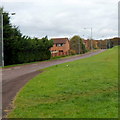
IMAGES TAKEN NEAR TO
Valentine Lane, CHEPSTOW, NP16 5TH

Introduction

This page details the photographs taken nearby to Valentine Lane, NP16 5TH by members of the Geograph project.

The Geograph project started in 2005 with the aim of publishing, organising and preserving representative images for every square kilometre of Great Britain, Ireland and the Isle of Man.

There are currently over 7.5m images from over14,400 individuals and you can help contribute to the project by visiting https://www.geograph.org.uk

Image Map


Images are licensed for reuse under creativecommons.org/licenses/by-sa/2.0
Notes
  • Clicking on the map will re-center to the selected point.
  • The higher the marker number, the further away the image location is from the centre of the postcode.

Image Listing (73 Images Found)

Images are licensed for reuse under creativecommons.org/licenses/by-sa/2.0
  • ...
Image
Details
Distance
1
Alice Crescent, Chepstow
Suburbia.
Image: © Jonathan Billinger Taken: 4 Jun 2012
0.08 miles
2
Collingwood Close
Off Denbigh Drive on the southern outskirts of Chepstow.
Image: © Jonathan Billinger Taken: 4 Jun 2012
0.09 miles
3
Leaping Salmon
Between Bulwark and Thornwell on the Wales Coast Path is this statue of a leaping salmon. The leaping salmon is the logo of the Wye Valley Walk which coincides here with the Wales Coast Path.
Image: © Eirian Evans Taken: 22 Jul 2015
0.10 miles
4
End of the pavement near Cidermill Close, Chepstow
The pavement ends a few metres ahead. The unnamed road, heading NE away from the roundabout at the southern end of Thornwell Road, passes houses in Cidermill Close on the left.
Image: © Jaggery Taken: 13 Nov 2012
0.11 miles
5
Wales Coast Path, South Chepstow
The long distance footpath heads through a small section of woods as it seeks to enter the town of Chepstow by following as close as possible to the banks of the River Wye
Image: © Chris Heaton Taken: 11 Feb 2016
0.12 miles
6
Chepstow : Bushes & River Wye
Looking across towards the River Wye from a footpath.
Image: © Lewis Clarke Taken: 14 Feb 2012
0.13 miles
7
Chepstow : Grassy Field
A grassy field with a path heading down to the River Wye under the railway.
Image: © Lewis Clarke Taken: 14 Feb 2012
0.13 miles
8
Snow on Bluebell drive
A snowy scene looking down Bluebell drive in bulwark, Chepstow on 06/01/2010
Image: © Mark Hobbs Taken: 6 Jan 2010
0.13 miles
9
Footpath leading down to the River Wye
Right of Way leading off the Wales Coast Path towards the bridge under the railway. Signs indicate the path is a dead end, and beyond this trespassers will be prosecuted.
Image: © Chris Heaton Taken: 11 Feb 2016
0.13 miles
10
Entrance to Park Redding
Dog-walker's domain near the southern estates of Chepstow.
Image: © Jonathan Billinger Taken: 4 Jun 2012
0.13 miles
  • ...