IMAGES TAKEN NEAR TO
Turnpike Close, CHEPSTOW, NP16 5SD
Introduction
This page details the photographs taken nearby to Turnpike Close, NP16 5SD by members of the Geograph project.
The Geograph project started in 2005 with the aim of publishing, organising and preserving representative images for every square kilometre of Great Britain, Ireland and the Isle of Man.

There are currently over 7.5m images from over14,400 individuals and you can help contribute to the project by visiting https://www.geograph.org.uk
Image Map
Images are licensed for reuse under creativecommons.org/licenses/by-sa/2.0
Notes
- Clicking on the map will re-center to the selected point.
- The higher the marker number, the further away the image location is from the centre of the postcode.
Image Listing (27 Images Found)
Images are licensed for reuse under creativecommons.org/licenses/by-sa/2.0
Image
Details
Distance
2
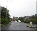
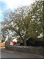
Barnets Wood, a residential road, in the west of Chepstow
Image: © David Smith
Taken: 18 Oct 2017
0.06 miles
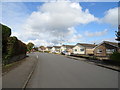
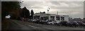
5
St Kingsmark Avenue Recreation Ground Chepstow
Image: © Roy Hughes
Taken: 27 Oct 2017
0.16 miles
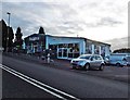
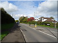
6
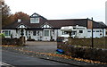
The Racecourse Guesthouse, Chepstow
The St Lawrence Road guesthouse is located near the southern edge of Chepstow racecourse.
Image: © Jaggery
Taken: 13 Nov 2012
0.17 miles
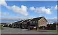
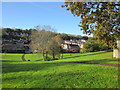
7
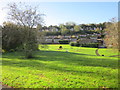
St Kingsmark Avenue Recreation Ground Chepstow (2)
Image: © Roy Hughes
Taken: 27 Oct 2017
0.17 miles