IMAGES TAKEN NEAR TO
Maple Avenue, CHEPSTOW, NP16 5RT
Introduction
This page details the photographs taken nearby to Maple Avenue, NP16 5RT by members of the Geograph project.
The Geograph project started in 2005 with the aim of publishing, organising and preserving representative images for every square kilometre of Great Britain, Ireland and the Isle of Man.

There are currently over 7.5m images from over14,400 individuals and you can help contribute to the project by visiting https://www.geograph.org.uk
Image Map
Images are licensed for reuse under creativecommons.org/licenses/by-sa/2.0
Notes
- Clicking on the map will re-center to the selected point.
- The higher the marker number, the further away the image location is from the centre of the postcode.
Image Listing (55 Images Found)
Images are licensed for reuse under creativecommons.org/licenses/by-sa/2.0
Image
Details
Distance
1
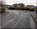
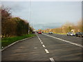
Bend near the SE end of Maple Avenue, Bulwark, Chepstow
Straight as an arrow for 700 metres behind the camera, the course of Maple Avenue bends to the left.
Image: © Jaggery
Taken: 15 Dec 2013
0.04 miles
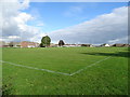
2
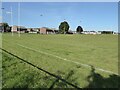
Playing field at Bulwark
Playing field at Bulwark on the southern edge of Chepstow.
Image: © Philip Halling
Taken: 20 Sep 2021
0.05 miles
3
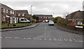
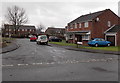
Hawthorn Close, Bulwark, Chepstow
Viewed across Maple Avenue.
Image: © Jaggery
Taken: 15 Dec 2013
0.06 miles
5
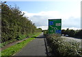
National Cycle Route 4
Heading for the Severn Road Bridge beside Wye Valley Link Road (A466).
Image: © JThomas
Taken: 15 Oct 2019
0.08 miles
6
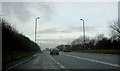
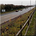
Lay-by on the Wye Valley link road Chepstow
Image: © Steve Fareham
Taken: 28 Jan 2009
0.09 miles
8
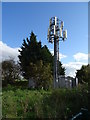
Communications mast beside National Cycle Route 4
Image: © JThomas
Taken: 15 Oct 2019
0.10 miles
9
Holly Close, Bulwark, Chepstow
Viewed across Maple Avenue.
Image: © Jaggery
Taken: 15 Dec 2013
0.12 miles
10
Monmouthshire boundary sign, Chepstow
Viewed across the A466 Wye Valley Link Road from a footpath and cycleway.
The sign behind the boundary sign shows 2 (miles) to the centre of Chepstow, 17 to Monmouth.
Image: © Jaggery
Taken: 15 Dec 2013
0.13 miles