IMAGES TAKEN NEAR TO
Hardwick Hill, CHEPSTOW, NP16 5PW
Introduction
This page details the photographs taken nearby to Hardwick Hill, NP16 5PW by members of the Geograph project.
The Geograph project started in 2005 with the aim of publishing, organising and preserving representative images for every square kilometre of Great Britain, Ireland and the Isle of Man.

There are currently over 7.5m images from over14,400 individuals and you can help contribute to the project by visiting https://www.geograph.org.uk
Image Map
Images are licensed for reuse under creativecommons.org/licenses/by-sa/2.0
Notes
- Clicking on the map will re-center to the selected point.
- The higher the marker number, the further away the image location is from the centre of the postcode.
Image Listing (169 Images Found)
Images are licensed for reuse under creativecommons.org/licenses/by-sa/2.0
Image
Details
Distance
1
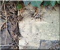
Ordnance Survey Cut Mark
This very worn OS cut mark can be found on the stone post at the junction of Vauxhall Road. It marks a point 86.862m above mean sea level.
Image: © Adrian Dust
Taken: 1 Feb 2022
0.03 miles
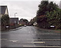
2
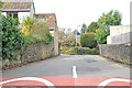
Chepstow : Vauxhall Road
A road off the A48.
Image: © Lewis Clarke
Taken: 22 Mar 2023
0.03 miles
3
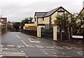
Vauxhall Road, Chepstow
Viewed across the A48.
Image: © Jaggery
Taken: 15 Dec 2013
0.04 miles
4
![Chepstow houses [34]](https://s3.geograph.org.uk/geophotos/07/35/68/7356895_7998d410_120x120.jpg)
Chepstow houses [34]
Stratheden, Number 4 Hardwick House, Hardwick Hill, is part of a complex of four dwellings. Built in the early to mid 19th century as part of the development of the area following the creation of a new road in 1808 'for easing the Hill'. Formerly called Oak field and later Hardwick Hall. Constructed of rendered brick under a hipped slate roof. Listed, grade II, with details at: https://cadwpublic-api.azurewebsites.net/reports/listedbuilding/FullReport?lang=&id=27120
Chepstow, the most easterly town in Wales, is located on the tidal River Wye, some 3 miles above its confluence with the River Severn. There is evidence of continuous human occupation from the Mesolithic period. The town grew in importance when the Normans erected a castle at what was the lowest bridging point of the River Wye. The town flourished as a port, being exempt from English taxation, and it mainly traded in timber and bark from the Wye Valley. The town became an important centre for tourism from the late eighteenth century.
Image: © Michael Dibb
Taken: 2 Sep 2022
0.05 miles
5
![Chepstow houses [32]](https://s0.geograph.org.uk/geophotos/07/35/68/7356892_c25f7210_120x120.jpg)
Chepstow houses [32]
Number 2 Hardwick House, Hardwick Hill, seen here, and number 3 Hardwick House Image are part of a complex of four dwellings. Number 2 faces the main road, number 3 is at right angles but shares a side frontage with number 2. Built in the early to mid 19th century as part of the development of the area following the creation of a new road in 1808 'for easing the Hill'. Formerly called Oak field and later Hardwick Hall. Constructed of rendered brick under a hipped slate roof. Listed, grade II, with details at: https://cadwpublic-api.azurewebsites.net/reports/listedbuilding/FullReport?lang=&id=27118
Chepstow, the most easterly town in Wales, is located on the tidal River Wye, some 3 miles above its confluence with the River Severn. There is evidence of continuous human occupation from the Mesolithic period. The town grew in importance when the Normans erected a castle at what was the lowest bridging point of the River Wye. The town flourished as a port, being exempt from English taxation, and it mainly traded in timber and bark from the Wye Valley. The town became an important centre for tourism from the late eighteenth century.
Image: © Michael Dibb
Taken: 2 Sep 2022
0.06 miles
6
![Chepstow houses [33]](https://s2.geograph.org.uk/geophotos/07/35/68/7356894_df3ad791_120x120.jpg)
Chepstow houses [33]
Number 3 Hardwick House, Hardwick Hill, seen here, and number 2 Hardwick House Image are part of a complex of four dwellings. Number 2 faces the main road, number 3 is at right angles but shares a side frontage with number 2. Built in the early to mid 19th century as part of the development of the area following the creation of a new road in 1808 'for easing the Hill'. Formerly called Oak field and later Hardwick Hall. Constructed of rendered brick under a hipped slate roof. Listed, grade II, with details at: https://cadwpublic-api.azurewebsites.net/reports/listedbuilding/FullReport?lang=&id=27119
Chepstow, the most easterly town in Wales, is located on the tidal River Wye, some 3 miles above its confluence with the River Severn. There is evidence of continuous human occupation from the Mesolithic period. The town grew in importance when the Normans erected a castle at what was the lowest bridging point of the River Wye. The town flourished as a port, being exempt from English taxation, and it mainly traded in timber and bark from the Wye Valley. The town became an important centre for tourism from the late eighteenth century.
Image: © Michael Dibb
Taken: 2 Sep 2022
0.06 miles
7
![Chepstow houses [31]](https://s2.geograph.org.uk/geophotos/07/35/68/7356890_66b9880c_120x120.jpg)
Chepstow houses [31]
Only a side elevation is viewable of number 1 Hardwick House, Hardwick Hill. It is part of a complex of four dwellings, built in the early to mid 19th century as part of the development of the area following the creation of a new road in 1808 'for easing the Hill'. Formerly called Oak field and later Hardwick Hall. It was a private school from 1930s until the later 20th century. Constructed of rendered brick under a hipped slate roof. Listed, grade II, with details at: https://cadwpublic-api.azurewebsites.net/reports/listedbuilding/FullReport?lang=&id=27118
Chepstow, the most easterly town in Wales, is located on the tidal River Wye, some 3 miles above its confluence with the River Severn. There is evidence of continuous human occupation from the Mesolithic period. The town grew in importance when the Normans erected a castle at what was the lowest bridging point of the River Wye. The town flourished as a port, being exempt from English taxation, and it mainly traded in timber and bark from the Wye Valley. The town became an important centre for tourism from the late eighteenth century.
Image: © Michael Dibb
Taken: 2 Sep 2022
0.06 miles
8
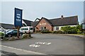
Chepstow : Two Rivers
A restaurant in Chepstow.
Image: © Lewis Clarke
Taken: 22 Mar 2023
0.06 miles
9
Larkfield Park, Chepstow
Larkfield Park is a cul-de-sac on the SE side of the A48 Newport Road.
Image: © Jaggery
Taken: 15 Dec 2013
0.07 miles
10
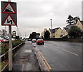
Steep and bendy descent into Chepstow ahead
The sign is alongside the A48. The 10% gradient sign shows a 1 in 10 descent ahead.
Image: © Jaggery
Taken: 15 Dec 2013
0.07 miles