IMAGES TAKEN NEAR TO
Mount Pleasant, CHEPSTOW, NP16 5PS
Introduction
This page details the photographs taken nearby to Mount Pleasant, NP16 5PS by members of the Geograph project.
The Geograph project started in 2005 with the aim of publishing, organising and preserving representative images for every square kilometre of Great Britain, Ireland and the Isle of Man.

There are currently over 7.5m images from over14,400 individuals and you can help contribute to the project by visiting https://www.geograph.org.uk
Image Map
Images are licensed for reuse under creativecommons.org/licenses/by-sa/2.0
Notes
- Clicking on the map will re-center to the selected point.
- The higher the marker number, the further away the image location is from the centre of the postcode.
Image Listing (570 Images Found)
Images are licensed for reuse under creativecommons.org/licenses/by-sa/2.0
Image
Details
Distance
1
![Chepstow houses [21]](https://s0.geograph.org.uk/geophotos/07/35/68/7356872_8e93608d_120x120.jpg)
Chepstow houses [21]
Number 3 Mount Pleasant, was built circa 1832. A new road 'for easing the Hill' was built in 1809. Originally called Moor Hill - a continuation of Moor Street - it was named Mount Pleasant when it was developed for housing. Constructed of stuccoed brick under a slate roof. Numbers 2 and 3 may be alterations of an existing building originally fronting Steep Street. Listed, grade II, with details at: https://cadwpublic-api.azurewebsites.net/reports/listedbuilding/FullReport?lang=&id=27122
Chepstow, the most easterly town in Wales, is located on the tidal River Wye, some 3 miles above its confluence with the River Severn. There is evidence of continuous human occupation from the Mesolithic period. The town grew in importance when the Normans erected a castle at what was the lowest bridging point of the River Wye. The town flourished as a port, being exempt from English taxation, and it mainly traded in timber and bark from the Wye Valley. The town became an important centre for tourism from the late eighteenth century.
Image: © Michael Dibb
Taken: 2 Sep 2022
0.00 miles
2
![Chepstow houses [22]](https://s1.geograph.org.uk/geophotos/07/35/68/7356873_03b33221_120x120.jpg)
Chepstow houses [22]
Numbers 4 and 5 Mount Pleasant were built circa 1832. A new road 'for easing the Hill' was built in 1809. Originally called Moor Hill - a continuation of Moor Street - it was named Mount Pleasant when it was developed for housing. Constructed of stuccoed brick under a slate roof. Listed, grade II, with details at: https://cadwpublic-api.azurewebsites.net/reports/listedbuilding/FullReport?lang=&id=27123 (Number 4) and at: https://cadwpublic-api.azurewebsites.net/reports/listedbuilding/FullReport?lang=&id=27124 (number 5)
Chepstow, the most easterly town in Wales, is located on the tidal River Wye, some 3 miles above its confluence with the River Severn. There is evidence of continuous human occupation from the Mesolithic period. The town grew in importance when the Normans erected a castle at what was the lowest bridging point of the River Wye. The town flourished as a port, being exempt from English taxation, and it mainly traded in timber and bark from the Wye Valley. The town became an important centre for tourism from the late eighteenth century.
Image: © Michael Dibb
Taken: 2 Sep 2022
0.00 miles
3
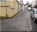
Steep Street, Chepstow
From Moor Street up Steep Street towards Hardwick Hill Lane.
Image: © Jaggery
Taken: 19 Feb 2018
0.01 miles
4
![Chepstow houses [20]](https://s3.geograph.org.uk/geophotos/07/35/68/7356871_a8c1eac5_120x120.jpg)
Chepstow houses [20]
Number 2 Mount Pleasant, was built circa 1832. A new road 'for easing the Hill' was built in 1809. Originally called Moor Hill - a continuation of Moor Street - it was named Mount Pleasant when it was developed for housing. Constructed of stuccoed brick under a slate roof. Numbers 2 and 3 may be alterations of an existing building originally fronting Steep Street. Listed, grade II, with details at: https://cadwpublic-api.azurewebsites.net/reports/listedbuilding/FullReport?lang=&id=2568
Chepstow, the most easterly town in Wales, is located on the tidal River Wye, some 3 miles above its confluence with the River Severn. There is evidence of continuous human occupation from the Mesolithic period. The town grew in importance when the Normans erected a castle at what was the lowest bridging point of the River Wye. The town flourished as a port, being exempt from English taxation, and it mainly traded in timber and bark from the Wye Valley. The town became an important centre for tourism from the late eighteenth century.
Image: © Michael Dibb
Taken: 2 Sep 2022
0.01 miles
5
![Chepstow houses [23]](https://s2.geograph.org.uk/geophotos/07/35/68/7356874_93622e15_120x120.jpg)
Chepstow houses [23]
Numbers 6 and 7 Mount Pleasant were built circa 1832. A new road 'for easing the Hill' was built in 1809. Originally called Moor Hill - a continuation of Moor Street - it was named Mount Pleasant when it was developed for housing. Constructed of stuccoed brick under a slate roof. Listed, grade II, with details at: https://cadwpublic-api.azurewebsites.net/reports/listedbuilding/FullReport?lang=&id=27125 (Number 6) and at: https://cadwpublic-api.azurewebsites.net/reports/listedbuilding/FullReport?lang=&id=27126 (number 7)
Chepstow, the most easterly town in Wales, is located on the tidal River Wye, some 3 miles above its confluence with the River Severn. There is evidence of continuous human occupation from the Mesolithic period. The town grew in importance when the Normans erected a castle at what was the lowest bridging point of the River Wye. The town flourished as a port, being exempt from English taxation, and it mainly traded in timber and bark from the Wye Valley. The town became an important centre for tourism from the late eighteenth century.
Image: © Michael Dibb
Taken: 2 Sep 2022
0.01 miles
6
![Chepstow houses [27]](https://s2.geograph.org.uk/geophotos/07/35/68/7356878_701be2ed_120x120.jpg)
Chepstow houses [27]
Number 14 Steep Street is an additional house between numbers 7 and 8 Mount Pleasant. The house has a narrow frontage to Steep Street and is created by flying freeholds. It has 3 storeys, a single window to each floor and a projecting gabled extension. Constructed of stuccoed brick under a slate roof. Listed, grade II, with details at: https://cadwpublic-api.azurewebsites.net/reports/listedbuilding/FullReport?lang=&id=27127
Chepstow, the most easterly town in Wales, is located on the tidal River Wye, some 3 miles above its confluence with the River Severn. There is evidence of continuous human occupation from the Mesolithic period. The town grew in importance when the Normans erected a castle at what was the lowest bridging point of the River Wye. The town flourished as a port, being exempt from English taxation, and it mainly traded in timber and bark from the Wye Valley. The town became an important centre for tourism from the late eighteenth century.
Image: © Michael Dibb
Taken: 2 Sep 2022
0.01 miles
7
![Chepstow houses [18]](https://s1.geograph.org.uk/geophotos/07/35/68/7356869_8edbf96d_120x120.jpg)
Chepstow houses [18]
Hathaway House, number 1 Mount Pleasant, was built circa 1832. A new road 'for easing the Hill' was built in 1809. Originally called Moor Hill - a continuation of Moor Street - it was named Mount Pleasant when it was developed for housing. Constructed of stuccoed brick under a slate roof. There is an extension to the left. The house has a rear elevation to Steep Street. Listed, grade II, with details at: https://cadwpublic-api.azurewebsites.net/reports/listedbuilding/FullReport?lang=&id=2570
Chepstow, the most easterly town in Wales, is located on the tidal River Wye, some 3 miles above its confluence with the River Severn. There is evidence of continuous human occupation from the Mesolithic period. The town grew in importance when the Normans erected a castle at what was the lowest bridging point of the River Wye. The town flourished as a port, being exempt from English taxation, and it mainly traded in timber and bark from the Wye Valley. The town became an important centre for tourism from the late eighteenth century.
Image: © Michael Dibb
Taken: 2 Sep 2022
0.01 miles
8
![Chepstow houses [19]](https://s2.geograph.org.uk/geophotos/07/35/68/7356870_7dc9156e_120x120.jpg)
Chepstow houses [19]
Hathaway House, number 1 Mount Pleasant, Image has a rear elevation to Steep Street and access is through this early 19th century iron garden gate. Listed, grade II, with details at: https://cadwpublic-api.azurewebsites.net/reports/listedbuilding/FullReport?lang=&id=2571
Chepstow, the most easterly town in Wales, is located on the tidal River Wye, some 3 miles above its confluence with the River Severn. There is evidence of continuous human occupation from the Mesolithic period. The town grew in importance when the Normans erected a castle at what was the lowest bridging point of the River Wye. The town flourished as a port, being exempt from English taxation, and it mainly traded in timber and bark from the Wye Valley. The town became an important centre for tourism from the late eighteenth century.
Image: © Michael Dibb
Taken: 2 Sep 2022
0.02 miles
9
![Chepstow houses [26]](https://s1.geograph.org.uk/geophotos/07/35/68/7356877_f0a36f9c_120x120.jpg)
Chepstow houses [26]
Number 10 is late 18th century in Cottage Orné style. Steep Street was the original main road to Newport and subsequently turnpiked and known as Back Hill until 1832. What is now the front door of number 10 formerly gave access to a passage leading to cottages at the rear. Constructed of rendered brick under a tile roof. The windows are casements with Gothick leaded glazing. Listed, grade II, with details at: https://cadwpublic-api.azurewebsites.net/reports/listedbuilding/FullReport?lang=&id=2587
Chepstow, the most easterly town in Wales, is located on the tidal River Wye, some 3 miles above its confluence with the River Severn. There is evidence of continuous human occupation from the Mesolithic period. The town grew in importance when the Normans erected a castle at what was the lowest bridging point of the River Wye. The town flourished as a port, being exempt from English taxation, and it mainly traded in timber and bark from the Wye Valley. The town became an important centre for tourism from the late eighteenth century.
Image: © Michael Dibb
Taken: 2 Sep 2022
0.02 miles
10
![Chepstow houses [24]](https://s3.geograph.org.uk/geophotos/07/35/68/7356875_7b2b6436_120x120.jpg)
Chepstow houses [24]
Numbers 9 and 10 Mount Pleasant were built circa 1832. A new road 'for easing the Hill' was built in 1809. Originally called Moor Hill - a continuation of Moor Street - it was named Mount Pleasant when it was developed for housing. Constructed of stuccoed brick under a slate roof. Listed, grade II, with details at: https://cadwpublic-api.azurewebsites.net/reports/listedbuilding/FullReport?lang=&id=27129 (Number 9) and at: https://cadwpublic-api.azurewebsites.net/reports/listedbuilding/FullReport?lang=&id=27130 (number 10)
Chepstow, the most easterly town in Wales, is located on the tidal River Wye, some 3 miles above its confluence with the River Severn. There is evidence of continuous human occupation from the Mesolithic period. The town grew in importance when the Normans erected a castle at what was the lowest bridging point of the River Wye. The town flourished as a port, being exempt from English taxation, and it mainly traded in timber and bark from the Wye Valley. The town became an important centre for tourism from the late eighteenth century.
Image: © Michael Dibb
Taken: 2 Sep 2022
0.02 miles