1
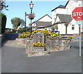
Raglan War Memorial in 2010
The memorial is on the corner of Chepstow Road and High Street, on the edge of Beaufort Square.
http://www.geograph.org.uk/photo/1754018 to a view in early spring, and details of the inscription.
https://www.geograph.org.uk/photo/6731293 to the same location in November 2020.
Image: © Jaggery
Taken: 26 Sep 2010
0.02 miles
2
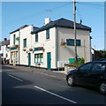
High Street pharmacy, Raglan
Premises of H.Shackleton, on High Street, at the western edge of Beaufort Square.
Image: © Jaggery
Taken: 26 Sep 2010
0.02 miles
3
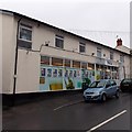
Watkins of Raglan
Nisa Local store on the south side of High Street Raglan.
Image: © Jaggery
Taken: 5 Jan 2014
0.03 miles
4
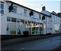
Nisa Local, High Street, Raglan
Closed on Christmas Day 2019.
Image: © Jaggery
Taken: 25 Dec 2019
0.03 miles
5
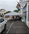
Jubilee Street Party preparations, High Street, Raglan
Viewed at 9:40am on Sunday June 5th 2022. High Street Raglan will be closed to traffic from 12 noon today for a street party to celebrate Queen Elizabeth II's Platinum Jubilee.
Image: © Jaggery
Taken: 5 Jun 2022
0.03 miles
6
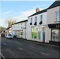
Nisa Local, High Street, Raglan
Convenience store on the south side of High Street.
Extons https://www.geograph.org.uk/photo/6720932 is on the right.
Image: © Jaggery
Taken: 22 Nov 2020
0.03 miles
7
Five bins, High Street, Raglan, Monmouthshire
The bin nearest the camera is for general waste (items which cannot be recycled).
The other four bins are for recycling items such as glass (in the turquoise bin
one from the right).
Image: © Jaggery
Taken: 14 Jul 2024
0.03 miles
8
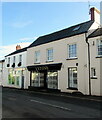
Extons, High Street, Raglan, Monmouthshire
Clothing shop located in Bristol House, High Street, Raglan viewed in November 2020.
Image: © Jaggery
Taken: 22 Nov 2020
0.03 miles
9
The Apartment, Bristol House, Raglan, Monmouthshire
On the south side of High Street, next door to Extons https://www.geograph.org.uk/photo/6720932 on the left.
Image: © Jaggery
Taken: 22 Nov 2020
0.03 miles
10
Midday Christmas 2017
Raglan Post Office on a wet and breezy Christmas Day.
Image: © Roger Davies
Taken: 25 Dec 2017
0.03 miles


