IMAGES TAKEN NEAR TO
Penrhos, Raglan, USK, NP15 2DE
Introduction
This page details the photographs taken nearby to NP15 2DE by members of the Geograph project.
The Geograph project started in 2005 with the aim of publishing, organising and preserving representative images for every square kilometre of Great Britain, Ireland and the Isle of Man.

There are currently over 7.5m images from over14,400 individuals and you can help contribute to the project by visiting https://www.geograph.org.uk
Image Map
Images are licensed for reuse under creativecommons.org/licenses/by-sa/2.0
Notes
- Clicking on the map will re-center to the selected point.
- The higher the marker number, the further away the image location is from the centre of the postcode.
Image Listing (12 Images Found)
Images are licensed for reuse under creativecommons.org/licenses/by-sa/2.0
Image
Details
Distance
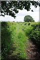
2
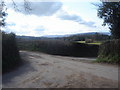
Road to Upper Clawdd Farm
The green to the left is what's left of a track to Tynewydd Farm. It is now a footpath.
Image: © Ruth Sharville
Taken: 13 Mar 2007
0.14 miles
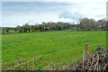
4
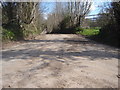
Country lane from junction with another country lane
Hard to stop to photograph these junctions, as they are on single track roads with very few passing places, so I just stopped at the junction, wound the window down and took the picture.
Image: © Ruth Sharville
Taken: 13 Mar 2007
0.18 miles
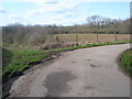
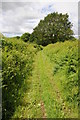
5
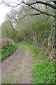
Green lane and right of way
Green lane and right of way to the east of Llanarth.
Image: © Philip Halling
Taken: 9 Jun 2012
0.19 miles
6
From the Tynewydd byway
One of those photos where you hold the camera above your head, over the hedge, to see what you get. A pasture. One of many.
Image: © Graham Horn
Taken: 13 Apr 2012
0.19 miles
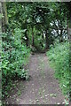
7
Green lane
Green lane and right of way near Wernrheolydd.
Image: © Philip Halling
Taken: 9 Jun 2012
0.19 miles
8
Green lane to Llanarth
Green lane and right of way to Llanarth.
Image: © Philip Halling
Taken: 9 Jun 2012
0.20 miles
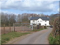
9
Byway to Tynewydd Farm
This is shown on the map as a white road, but with those green dots to indicate that it is a public right of way really, namely "other route with public access". Road or path? Technically road I think.
Image: © Graham Horn
Taken: 13 Apr 2012
0.20 miles
10
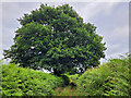
Oak tree by the green lane
Looking west towards Llaca-du.
Image: © Jonathan Billinger
Taken: 5 Jul 2022
0.20 miles