IMAGES TAKEN NEAR TO
Penycaemawr, USK, NP15 1NG
Introduction
This page details the photographs taken nearby to NP15 1NG by members of the Geograph project.
The Geograph project started in 2005 with the aim of publishing, organising and preserving representative images for every square kilometre of Great Britain, Ireland and the Isle of Man.

There are currently over 7.5m images from over14,400 individuals and you can help contribute to the project by visiting https://www.geograph.org.uk
Image Map
Images are licensed for reuse under creativecommons.org/licenses/by-sa/2.0
Notes
- Clicking on the map will re-center to the selected point.
- The higher the marker number, the further away the image location is from the centre of the postcode.
Image Listing (4 Images Found)
Images are licensed for reuse under creativecommons.org/licenses/by-sa/2.0
Image
Details
Distance
1
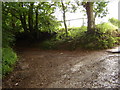
Turn right to The Warren, left to Craig-y-Master
Image: © Ruth Sharville
Taken: 16 Jun 2007
0.12 miles
2
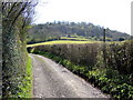
Warren Lane
Looking south with Warren Wood in view.
Image: © Jonathan Billinger
Taken: 7 Apr 2009
0.18 miles
3
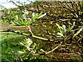
Rowan leaves and buds
Sorbus sp. on the edge of a hazel copse by Warren Lane.
Image: © Jonathan Billinger
Taken: 7 Apr 2009
0.24 miles
4
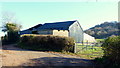
Farm buildings at Fernhill
The end of the public road.
Image: © Jonathan Billinger
Taken: 3 Dec 2014
0.25 miles