1
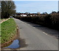
Warning sign - bend ahead, Chepstow Road, Gwernesney, Monmouthshire
On the approach to a bend in the B4235 Chepstow Road at the Monmouth Road junction.
Image: © Jaggery
Taken: 25 Mar 2018
0.11 miles
2
Gwernesney boundary sign, Monmouthshire
The B4235 Chepstow Road from Usk reaches the small village of Gwernesney (Gwernesni in Welsh).
The National Speed Limit drops to 40mph.
Image: © Jaggery
Taken: 25 Mar 2018
0.14 miles
3
End of the 40mph speed limit beyond Gwernesney, Monmouthshire
The speed limit on the B4235 Chepstow Road towards Usk increases to the National Speed Limit.
The grey back of the Gwernesney boundary sign https://www.geograph.org.uk/photo/5716261 is on the right.
Image: © Jaggery
Taken: 25 Mar 2018
0.14 miles
4
Chepstow Road towards Gwernesney, Monmouthshire
The B4235 Chepstow Road approaches the Gwernesney village boundary sign. https://www.geograph.org.uk/photo/5716261
Image: © Jaggery
Taken: 25 Mar 2018
0.14 miles
5
Trees and hedges, Gwernesney, Monmouthshire
Viewed across Monmouth Road in late September 2021.
Image: © Jaggery
Taken: 26 Sep 2021
0.14 miles
6
Unsuitable lane for HGVs, Gwernesney, Monmouthshire
From Monmouth Road, the lane leads to a church.
Image: © Jaggery
Taken: 26 Sep 2021
0.17 miles
7
Field gates, Gwernesney, Monmouthshire
Viewed across Monmouth Road.
Image: © Jaggery
Taken: 26 Sep 2021
0.18 miles
8
Lane towards a church, Gwernesney, Monmouthshire
From Monmouth Road towards St Michael & All Angels Church. https://www.geograph.org.uk/photo/6973464 A sign https://www.geograph.org.uk/photo/6973227 behind the camera shows that this lane is unsuitable for heavy goods vehicles.
Image: © Jaggery
Taken: 26 Sep 2021
0.18 miles
9
Usk Showground entrance near Gwernesney, Monmouthshire
Entrance to the 100 acre showground site from the B4235 Chepstow Road, about 3km (c2 miles) from the centre of Usk. Usk Showground is the location of the Usk Show which celebrates Monmouthshire farming and rural life. Organised by Usk Farmers' Club, Usk Show has been held on the second Saturday in September every year since 1844. It is now one of the biggest one-day agricultural shows in the UK.
Image: © Jaggery
Taken: 25 Mar 2018
0.21 miles
10
Gates to the Usk Showground, near Gwernesney
Image: © Ruth Sharville
Taken: 7 Feb 2023
0.21 miles


