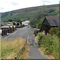
1
Southlands houses, Blaina
Southlands is an area of housing east of High Street. Former colliery winding wheels http://www.geograph.org.uk/photo/3576317 are on the grass behind the camera.
Image: © Jaggery
Taken: 26 Jul 2013
0.04 miles
2
Winding wheels, Southlands, Blaina
The former colliery winding wheels are on the west side of the street named Southlands. There was no plaque nor any other information here to give the history of the wheels or the reason for their current location.
Image: © Jaggery
Taken: 26 Jul 2013
0.05 miles
3
Queen Street houses, Blaina
View from the High Street end looking towards The White Lion Inn. http://www.geograph.org.uk/photo/3576276
Image: © Jaggery
Taken: 26 Jul 2013
0.10 miles
4
Front view of The White Lion Inn, Blaina
The White Lion is at the NE end of Queen Street, about 175 metres from High Street.
Image: © Jaggery
Taken: 26 Jul 2013
0.10 miles
5
Side view of The White Lion Inn, Blaina
The White Lion is at the NE end of Queen Street, about 175 metres from High Street.
Image: © Jaggery
Taken: 26 Jul 2013
0.10 miles
6
Heol Arthur Fear, Blaina
Viewed across Queen Street looking towards houses in a small cul-de-sac named after Arthur Fear (1902–1984), a native of Cwmcelyn, Blaina. He was a Welsh bass and baritone opera singer who had earlier been a coal miner.
Image: © Jaggery
Taken: 26 Jul 2013
0.10 miles
7
Row of four houses, Cwmcelyn Road, Blaina
Image: © Jaggery
Taken: 18 Sep 2013
0.12 miles
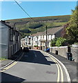
8
Towards Cross Street, Blaina
Looking past the end of a path from Southlands along an unnamed street towards Cross Street.
Image: © Jaggery
Taken: 26 Jul 2013
0.13 miles
9
Llys-y-Capel, Blaina
Viewed across Cross Street. Llys-y-Capel, Welsh for Chapel Court, was built in 1988. There are 28 flats. This is retirement/sheltered housing, with a non-resident management staff and community alarm service.
Image: © Jaggery
Taken: 26 Jul 2013
0.16 miles
10
Cwmcelyn Road, Blaina
Viewed looking towards High Street.
Image: © Jaggery
Taken: 18 Sep 2013
0.16 miles


