IMAGES TAKEN NEAR TO
Church Street, ABERTILLERY, NP13 3HD

Introduction

This page details the photographs taken nearby to Church Street, NP13 3HD by members of the Geograph project.

The Geograph project started in 2005 with the aim of publishing, organising and preserving representative images for every square kilometre of Great Britain, Ireland and the Isle of Man.

There are currently over 7.5m images from over14,400 individuals and you can help contribute to the project by visiting https://www.geograph.org.uk

Image Map


Images are licensed for reuse under creativecommons.org/licenses/by-sa/2.0
Notes
  • Clicking on the map will re-center to the selected point.
  • The higher the marker number, the further away the image location is from the centre of the postcode.

Image Listing (66 Images Found)

Images are licensed for reuse under creativecommons.org/licenses/by-sa/2.0
  • ...
Image
Details
Distance
1
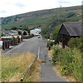
Towards Cross Street, Blaina
Looking past the end of a path from Southlands along an unnamed street towards Cross Street.
Image: © Jaggery Taken: 26 Jul 2013
0.01 miles
2
Llys-y-Capel, Blaina
Viewed across Cross Street. Llys-y-Capel, Welsh for Chapel Court, was built in 1988. There are 28 flats. This is retirement/sheltered housing, with a non-resident management staff and community alarm service.
Image: © Jaggery Taken: 26 Jul 2013
0.04 miles
3
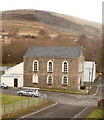
Blaina : chapel viewed from the NW
Gladstone Street Methodist Chapel viewed from Church Street.
Image: © Jaggery Taken: 3 Feb 2011
0.04 miles
4
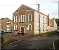
Gladstone Street Methodist Chapel, Blaina
Nineteenth century chapel facing Gladstone Street and Mill Street.
Image: © Jaggery Taken: 3 Feb 2011
0.04 miles
5
Sh'Eclipz Blaina
Sh'Eclipz is a unisex hair and tanning studio at 74 High Street.
Image: © Jaggery Taken: 18 Sep 2013
0.05 miles
6
Chapel and Pub
Centres of community life in a bygone era. Blaenau, Gwent.
Image: © Alan Hughes Taken: 9 Aug 2021
0.05 miles
7
The Bush, Blaina
Pub at 69 High Street.
Image: © Jaggery Taken: 18 Sep 2013
0.05 miles
8
The Little Book and Curio Shop, Blaina
The Little Book and Curio Shop at 71 High Street is flanked by Assets Estates on the left and Coffee Bar 72 on the right. A Google Earth Streetview taken in October 2009 shows that its neighbours were a shop named Buzz on its left and The Cabbage Patch (fruit and vegetable sellers) on its right.
Image: © Jaggery Taken: 18 Sep 2013
0.05 miles
9
Ordnance Survey Cut Mark
This OS cut mark can be found on the Post Office on High Street. It marks a point 281.248m above mean sea level.
Image: © Adrian Dust Taken: 30 Jun 2023
0.06 miles
10
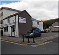
Treasured Photography in Blaina
Professional photography services business on the corner of High Street and Hope Street.
Image: © Jaggery Taken: 18 Sep 2013
0.06 miles
  • ...