1
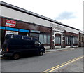
The Co-operative Food store, Blaina
The store is at 53 High Street, Blaina.
Image: © Jaggery
Taken: 26 Jul 2013
0.01 miles
2
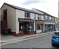
Pet Shop and Blaina News, High Street Blaina
Two shops on the west side of High Street.
Image: © Jaggery
Taken: 26 Jul 2013
0.02 miles
3
Council offices, Blaina
This is Blaenau Gwent County Borough council's Nantyglo & Blaina District Office in High Street Blaina.
A plaque http://www.geograph.org.uk/photo/3575045 on the wall commemorates the Blaina Riots of March 21st 1935.
Image: © Jaggery
Taken: 26 Jul 2013
0.03 miles
4
Former Public Market Hall, Blaina
Viewed across High Street.
Image: © Jaggery
Taken: 26 Jul 2013
0.03 miles
5
Lockup garages, Blaina
Located in a corner of a car park on the west side of High Street.
Image: © Jaggery
Taken: 26 Jul 2013
0.04 miles
6
Blaina Riot plaque
The plaque is on the wall here. http://www.geograph.org.uk/photo/3575014 The riot occurred during the prolonged economic depression of the 1930s. Many thousands of unemployed people from Blaina and neighbouring areas marched here, to what were at the time the local Public Assistance Committee offices. The harsh means test in use was hated by the unemployed. The ensuing confrontation between the marchers and police is known as the Blaina Riot or Riots.
Image: © Jaggery
Taken: 26 Jul 2013
0.04 miles
7
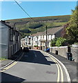
Cwmcelyn Road, Blaina
Viewed looking towards High Street.
Image: © Jaggery
Taken: 18 Sep 2013
0.04 miles
8
Friends of Blaina Hospital, High Street, Blaina
The Friends of Blaina Hospital in High Street opened in the mid 1990s. Staffed by locals, it is open five mornings a week, selling donated items such as bric-a-brac, CDs, books and toys. Funds raised were spent at Blaina Hospital until its closure in 2010. The charity bought things patients needed, such as televisions for wards and heart monitors. After the closure of the hospital, funds raised here have gone to the new Ysbyty Aneurin Bevan in Ebbw Vale.
Image: © Jaggery
Taken: 26 Jul 2013
0.04 miles
9
Recreation area in Blaina
Viewed from the road to Cwmcelyn. BMX and skateboard area on the left, multi-use games court on the right.
Image: © Jaggery
Taken: 18 Sep 2013
0.05 miles
10
The Asha Tandoori Balti Takeaway, Blaina
On the corner of High Street (on the left) and Cwmcelyn Road.
Image: © Jaggery
Taken: 26 Jul 2013
0.05 miles


