IMAGES TAKEN NEAR TO
High Street, ABERTILLERY, NP13 2RA

Introduction

This page details the photographs taken nearby to High Street, NP13 2RA by members of the Geograph project.

The Geograph project started in 2005 with the aim of publishing, organising and preserving representative images for every square kilometre of Great Britain, Ireland and the Isle of Man.

There are currently over 7.5m images from over14,400 individuals and you can help contribute to the project by visiting https://www.geograph.org.uk

Image Map


Images are licensed for reuse under creativecommons.org/licenses/by-sa/2.0
Notes
  • Clicking on the map will re-center to the selected point.
  • The higher the marker number, the further away the image location is from the centre of the postcode.

Image Listing (178 Images Found)

Images are licensed for reuse under creativecommons.org/licenses/by-sa/2.0
  • ...
Image
Details
Distance
1
Llanhilleth Hotel
Llanhilleth Hotel on a road junction off the B4471 in Llanhilleth.
Image: © Philip Halling Taken: 10 Aug 2012
0.02 miles
2
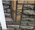
Ordnance Survey Cut Mark
This OS cut mark can be found on the old Wesleyan Chapel on Commercial Road. It marks a point 157.231m above mean sea level.
Image: © Adrian Dust Taken: 16 Aug 2021
0.02 miles
3
Path from High Street into Granny's Wood
Footpath goes down towards the Llanhilleth Colliery Memorial.
Image: © M J Roscoe Taken: 26 Jul 2022
0.02 miles
4
Ordnance Survey Cut Mark
This OS cut mark can be found on the former Llanhilleth PH. It marks a point 172.471m above mean sea level.
Image: © Adrian Dust Taken: 16 Aug 2021
0.03 miles
5
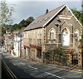
Former Wesleyan Church, High Street, Llanhilleth
Viewed in July 2023. The former church has been converted to flats.
Image: © Jaggery Taken: 26 Jul 2023
0.03 miles
6
Clearing verge of path, Granny's Wood
The path goes from the Colliery Memorial Image up to the High Street.
Image: © M J Roscoe Taken: 26 Jul 2022
0.04 miles
7
Train approaching Llanhilleth Station
A Gloucester to Ebbw Vale service approaches the single platform. The train is not running 'wrong line', as the second track is yet to be brought into use.
Image: © Gareth James Taken: 28 Dec 2016
0.04 miles
8
NEW ROAD LAYOUT 100yds, Llanhilleth
English / Welsh sign alongside the B4471 on the descent towards the centre of Llanhilleth.
Image: © Jaggery Taken: 26 Jul 2023
0.04 miles
9
Former Wesleyan Church, High Street, Llanhilleth
Image: © Ian S Taken: 25 May 2014
0.04 miles
10
High Street flats in former Wesleyan Church, Llanhilleth
Several flats now occupy the former church, located alongside a 1 in 7 (14%) incline on High Street, Llanhilleth.
Image: © Jaggery Taken: 6 Oct 2011
0.04 miles
  • ...