IMAGES TAKEN NEAR TO
Arail Farm Road, ABERTILLERY, NP13 2NR
Introduction
This page details the photographs taken nearby to Arail Farm Road, NP13 2NR by members of the Geograph project.
The Geograph project started in 2005 with the aim of publishing, organising and preserving representative images for every square kilometre of Great Britain, Ireland and the Isle of Man.

There are currently over 7.5m images from over14,400 individuals and you can help contribute to the project by visiting https://www.geograph.org.uk
Image Map
Images are licensed for reuse under creativecommons.org/licenses/by-sa/2.0
Notes
- Clicking on the map will re-center to the selected point.
- The higher the marker number, the further away the image location is from the centre of the postcode.
Image Listing (59 Images Found)
Images are licensed for reuse under creativecommons.org/licenses/by-sa/2.0
Image
Details
Distance
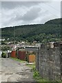
2
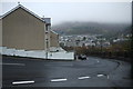
Houses and high ground, Six Bells
The view WNW from Bridge Street, Six Bells, a village near Abertillery.
Image: © Jaggery
Taken: 16 Feb 2011
0.09 miles
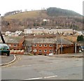
4
Six Bells, Abertillery, seen from the miners' memorial
Image: © John Lord
Taken: 11 Apr 2014
0.12 miles
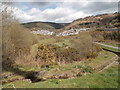
6
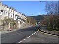
A Misty Day at Six Bells
Looking down Six Bells Rd into the valley. The site of the old colliery is just off to the right. This is right in the NE corner of the grid square and the houses in the distance are the main village of Six Bells in SO2203
Image: © Nigel Mykura
Taken: 21 Nov 2014
0.13 miles
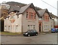
8
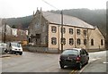
Bethany Baptist Church, Six Bells
Located on the corner of Chapel Road and Six Bells Road.
Image: © Jaggery
Taken: 16 Feb 2011
0.15 miles
9
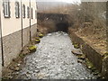
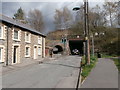
Ebbw Fach river, Six Bells
The Ebbw Fach flows between Bethany Baptist Church http://www.geograph.org.uk/photo/2274176 and Six Bells Road.
Ahead, the river disappears underground for about 100 metres.
Image: © Jaggery
Taken: 16 Feb 2011
0.15 miles
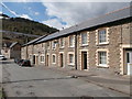
10
Arail Street flats, Six Bells
The distinctively shaped and coloured building at the southern end of Arail Street contains 8 flats.
Image: © Jaggery
Taken: 16 Feb 2011
0.15 miles