1
Six Bells
Image: © andy dolman
Taken: 9 Sep 2008
0.03 miles
2
Site of Six Bells Colliery
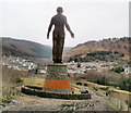
The Guardian of the Valleys figure keeps watch.
Image: © Gareth James
Taken: 24 Jul 2011
0.06 miles
3
Ordnance Survey Cut Mark
This OS cut mark can be found on the wall of the old school on Victoria Road. It marks a point 192.000m above mean sea level.
Image: © Adrian Dust
Taken: 16 Aug 2021
0.06 miles
4
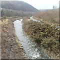
Ebbw Fach River, Six Bells
The view SW along the river and a parallel path, in the SW edge of the village of Six Bells. Near the upper right corner is the Guardian of the Valleys memorial statue. http://www.geograph.org.uk/photo/2274124
Image: © Jaggery
Taken: 16 Feb 2011
0.07 miles
5
Colliery memorial, Six Bells
Image: © Alan Hughes
Taken: 9 Aug 2021
0.07 miles
6
Small stepped waterfall adjacent to the Guardian of the Valleys, Six Bells
The waterfall is alongside the memorial statue. http://www.geograph.org.uk/photo/2274124
Image: © Jaggery
Taken: 16 Feb 2011
0.07 miles
7
Six Bells : river, track of dismantled railway and Victoria Road houses
A view SE from a path alongside the Ebbw Fawr River. In the foreground, a small stream enters the river at right angles. In the middle distance, between trees, is the route of a dismantled railway line. The nearby Six Bells Halt was closed in 1962. On higher ground in the distance are houses on Victoria Road.
Image: © Jaggery
Taken: 16 Feb 2011
0.07 miles
8
Guardian of the Valleys faces Six Bells
The statue http://www.geograph.org.uk/photo/2274124 faces the village of Six Bells, near Abertillery
Image: © Jaggery
Taken: 16 Feb 2011
0.07 miles
9
Guardian of the Valleys viewed from Victoria Road, Six Bells
The 20-metre high statue http://www.geograph.org.uk/photo/2274124, on the site of the former Six Bells colliery, commemorates the 45 men who were killed in the 1960 gas explosion.
Image: © Jaggery
Taken: 16 Feb 2011
0.07 miles
10
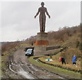
The Guardian of the Valleys, Six Bells
The 20 metre high statue is located on the site of the former Six Bells colliery. It is a memorial to the 45 miners who were killed in the Six Bells colliery disaster on June 28th 1960, caused by a gas explosion.
The statue of a lone miner was officially unveiled by the Archbishop of Canterbury Dr Rowan Williams on June 28th 2010, on the fiftieth anniversary of the disaster. Designed by Sebastien Boyesen, the statue is made from thousands of steel ribbons. Around the plinth are inscribed the names of all the men who died in the disaster.
Image: © Jaggery
Taken: 16 Feb 2011
0.07 miles


