1
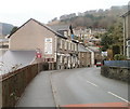
Victoria Road at The Six Bells Hotel, Six Bells
Image: © Colin Pyle
Taken: 4 Jun 2019
0.03 miles
2
Six Bells Hotel, Six Bells
Inn located on Victoria Road in the village of Six Bells near Abertillery. Though the origin of the name of the village is not certain, a likely explanation is that it was the name used for a small group of houses and cottages built near this inn in the middle of the nineteenth century.
Image: © Jaggery
Taken: 16 Feb 2011
0.06 miles
3
The Old Post Office, Graig Road, Six Bells
Private residence bearing the nameplate Old Post Office. Located on the corner of Bridge Street and Graig Road.
Image: © Jaggery
Taken: 16 Feb 2011
0.06 miles
4
Llys Cwm Llwydrhew, Six Bells
Located near the junction of Victoria Road and Bridge Street, viewed from Six Bells Road. There are 25 1- or 2-bedroom flats in Llys Cwm Llwydrhew, built in 1987. There is a resident management staff and community alarm service.
Image: © Jaggery
Taken: 16 Feb 2011
0.06 miles
5
Ordnance Survey Cut Mark
This OS cut mark can be found on No40 New High Street. It marks a point 215.899m above mean sea level.
Image: © Adrian Dust
Taken: 16 Aug 2021
0.07 miles
6
Ordnance Survey Cut Mark
This OS cut mark can be found on the wall of the old school on Victoria Road. It marks a point 192.000m above mean sea level.
Image: © Adrian Dust
Taken: 16 Aug 2021
0.09 miles
7
Chapel Road descends towards former railway bridge, Six Bells
The bridge now carries a footpath where once were railway lines. Pedestrians use the tunnel on the right side of the bridge. Near the left edge of the view is the original Six Bells Colliery memorial. http://www.geograph.org.uk/photo/2274154
Image: © Jaggery
Taken: 16 Feb 2011
0.10 miles
8
Footpath under Bridge Street, Six Bells
Viewed along Church Road, which bends to the right here. Ahead is a footpath through an underpass beneath Bridge Street. On each side of the underpass entrance is a vertical band showing SIX BELLS.
Image: © Jaggery
Taken: 16 Feb 2011
0.10 miles
9
Original Six Bells Colliery memorial
Located between Chapel Road and Bridge Street, Six Bells, the inscription on the memorial is DEDICATED TO THE MEMORY OF THE MEN WHO DIED IN THE DISASTER OF JUNE 28TH 1960 & TO ALL THOSE MINERS WHO LOST THEIR LIVES AT SIX BELLS COLLIERY 1897-1988.
It was during discussions about what to do with this memorial, which was in danger of falling into disrepair, that the decision was made to replace it with something more substantial. The outcome was the Guardian of the Valleys memorial statue. http://www.geograph.org.uk/photo/2274124
Image: © Jaggery
Taken: 16 Feb 2011
0.10 miles
10
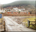
View towards Six Bells from the site of the former colliery
Image: © Gareth James
Taken: 24 Jul 2011
0.11 miles


