1
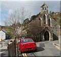
Junction of High Street and Brooklyn Terrace, Llanhilleth
Brooklyn Terrace on the right heads away from High Street, past St Mark's Church. http://www.geograph.org.uk/photo/2637248
Image: © Jaggery
Taken: 6 Oct 2011
0.01 miles
2
St Mark's Church, Llanhilleth
The twin-belled Church in Wales church is located on Brooklyn Terrace, near the High Street junction.
It is in the benefice of Abertillery with Cwmtillery with Llanhilleth with Six Bells, in the deanery of Pontypool. Built in 1898.
Image: © Jaggery
Taken: 6 Oct 2011
0.01 miles
3
South side of St Mark's church, Llanhilleth
The Church in Wales church is in the benefice of Abertillery with Cwmtillery with Llanhilleth with Six Bells, in the deanery of Pontypool. It was built in 1898.
Viewed across the B4471 named Commercial Road to the left of the church and High Street to the right. The church entrance http://www.geograph.org.uk/photo/2637248 is from Brooklyn Terrace.
Image: © Jaggery
Taken: 6 Oct 2011
0.01 miles
4
St Illtyd's Primary School, Llanhilleth viewed from the south
Looking north from the edge of the A467.
Image: © Jaggery
Taken: 6 Oct 2011
0.01 miles
5
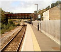
Two bridges, Llanhilleth
Viewed along the northern edge of Llanhilleth railway station. http://www.geograph.org.uk/photo/2825409
The nearer, newer bridge is a footbridge. Behind it is an arch of a road bridge.
Image: © Jaggery
Taken: 6 Oct 2011
0.01 miles
6
Road bridge over Llanhilleth railway station
A view west along the single platform at Llanhilleth. The road bridge crosses above the platform and track.
Image: © Jaggery
Taken: 6 Oct 2011
0.01 miles
7
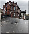
West side of Llanhilleth Miners' Institute
The Meadow Street building dating from 1906 was Grade II listed in 1999.
Image: © Jaggery
Taken: 25 Jan 2023
0.01 miles
8
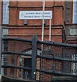
Bilingual name sign, Llanhilleth
The sign located here https://www.geograph.org.uk/photo/7429417 shows Llanhilleth Miner's Institute
and the Welsh Sefydliad Glowyr Llanhiledd
Image: © Jaggery
Taken: 25 Jan 2023
0.01 miles
9
Warning sign on the approach to a school, Llanhilleth
Showing "Patrol"and the Welsh equivalent, the sign is near speed bumps.
Image: © Jaggery
Taken: 25 Jan 2023
0.02 miles
10
War memorial
Image: © andy dolman
Taken: 5 Sep 2008
0.02 miles


