1
Ordnance Survey Cut Mark
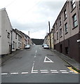
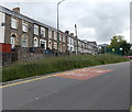
This OS cut mark can be found on No61 Clyn Mawr Street. It marks a point 253.051m above mean sea level.
Image: © Adrian Dust
Taken: 20 Jan 2018
0.02 miles
2
Oxford Street, Cwmtillery
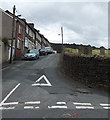
Oxford Street climbs away from Alma Street.
Here's http://www.geograph.org.uk/photo/1158857 a snowy view of the street.
Image: © Jaggery
Taken: 24 Jun 2013
0.02 miles
3
Abertillery from a Paraglider
Photo taken from 2000ft above during a fantastic weekend's flying in August 2005. Take off was from The Blorenge in
Image
Image: © Graham Richards
Taken: Unknown
0.04 miles
4
Preston Street, Blaenau Gwent
Viewed from Alma Street, Cwmtillery. On the right is the cemetery boundary wall of
Blaenau Gwent Baptist Church, Victoria Street.
Image: © Jaggery
Taken: 24 Jun 2013
0.04 miles
5
Ashfield Road, Abertillery
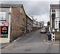
A one-way system, away from Alma Street, operates along Ashfield Road. Faint writing on the wall on the left is a relic of a previous use of the premises, now a takeaway. http://www.geograph.org.uk/photo/3526579
Image: © Jaggery
Taken: 24 Jun 2013
0.07 miles
6
Oxford street
Image: © andy dolman
Taken: 12 Feb 2009
0.07 miles
7
Perfect Image, Cwmtillery
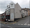
Unisex hair & beauty salon on the corner of Oxford Street and Alma Street.
Image: © Jaggery
Taken: 24 Jun 2013
0.08 miles
8
Row of houses, Alma Street, Abertillery
Viewed across Alma Street looking towards the southern boundary of Cwmtillery.
Image: © Jaggery
Taken: 24 Jun 2013
0.08 miles
9
Former Brynteg Congregational Church, Cwmtillery
Located on the corner of Oxford Street and Alma Street, Brynteg House contains 6 flats.
An inscription on the Alma Street side shows
BRYNTEG CONGREGATIONAL CHURCH
CHAPEL BUILT AD 1914.
Image: © Jaggery
Taken: 24 Jun 2013
0.08 miles
10
Alma Street houses, Abertillery
Houses on the west side of Alma Street, north of the Ashfield Road junction.
Image: © Jaggery
Taken: 24 Jun 2013
0.09 miles


