IMAGES TAKEN NEAR TO
Gladstone Street, ABERTILLERY, NP13 1NF

Introduction

This page details the photographs taken nearby to Gladstone Street, NP13 1NF by members of the Geograph project.

The Geograph project started in 2005 with the aim of publishing, organising and preserving representative images for every square kilometre of Great Britain, Ireland and the Isle of Man.

There are currently over 7.5m images from over14,400 individuals and you can help contribute to the project by visiting https://www.geograph.org.uk

Image Map


Images are licensed for reuse under creativecommons.org/licenses/by-sa/2.0
Notes
  • Clicking on the map will re-center to the selected point.
  • The higher the marker number, the further away the image location is from the centre of the postcode.

Image Listing (31 Images Found)

Images are licensed for reuse under creativecommons.org/licenses/by-sa/2.0
  • ...
Image
Details
Distance
1
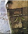
Ordnance Survey Cut Mark
This OS cut mark can be found on No41 Nuadd Street. It marks a point 246.833m above mean sea level.
Image: © Adrian Dust Taken: 20 Jan 2018
0.04 miles
2
Ordnance Survey Cut Mark
This OS cut mark can be found on No115 Oak Street. It marks a point 234.934m above mean sea level.
Image: © Adrian Dust Taken: 20 Jan 2018
0.05 miles
3
Ordnance Survey Cut Mark
This OS cut mark can be found on No16 Springbank. It marks a point 260.891m above mean sea level.
Image: © Adrian Dust Taken: 20 Jan 2018
0.08 miles
4
Ordnance Survey Cut Mark
This OS cut mark can be found on the garage SW side of the road. It marks a point 249.924m above mean sea level.
Image: © Adrian Dust Taken: 20 Jan 2018
0.09 miles
5
South side of B&B Garage, Abertillery
Viewed across the A467 from a footbridge. The garage's valeting bay is on the right with the similarly-coloured Oak Street side of the garage behind.
Image: © Jaggery Taken: 14 Jun 2013
0.09 miles
6
Ordnance Survey Rivet
This OS rivet can be found on the old school, Crown Street. It marks a point 271.287m above mean sea level.
Image: © Adrian Dust Taken: 20 Jan 2018
0.10 miles
7
A467 passes Abertillery
Image: © Colin Pyle Taken: 4 Jan 2018
0.11 miles
8
Ordnance Survey Cut Mark
This OS cut mark can be found on The Crown Inn, Victoria Street. It marks a point 273.765m above mean sea level.
Image: © Adrian Dust Taken: 20 Jan 2018
0.12 miles
9
Glandwr Street, Abertillery
Glandwr Street is a NW extension of Carlyle Street. The street name sign and its Please Drive Carefully message is in the style of a village or town boundary sign.
Image: © Jaggery Taken: 14 Jun 2013
0.13 miles
10
A valleys town
View over Abertillery from the slopes of Penrhiwgarreg.
Image: © Alan Hughes Taken: 9 Aug 2021
0.14 miles
  • ...