1
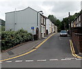
James Street, Abertillery
A view from High Street along James Street, a 70 metre long residential cul-de-sac.
Image: © Jaggery
Taken: 24 Jun 2013
0.06 miles
2
Ordnance Survey Cut Mark
This OS cut mark can be found on No3 Blythe Street. It marks a point 240.588m above mean sea level.
Image: © Adrian Dust
Taken: 20 Jan 2018
0.07 miles
3
57 pigeons
A flock of pigeons circling over Abertillery.
Image: © Alan Hughes
Taken: 9 Aug 2021
0.07 miles
4
Ordnance Survey Cut Mark
This OS cut mark can be found on the wall of No67 Powell Street. It marks a point 231.864m above mean sea level.
Image: © Adrian Dust
Taken: 20 Jan 2018
0.08 miles
5
Narrow section of Park Place, Abertillery
Viewed from Church Street.
In Abertillery, as in the rest of the UK, a double yellow line indicates that parking is not permitted at any time (24 hours). Loading or unloading is allowed on double (and single) yellow lines.
Perhaps the drivers of both the vehicles seen here were out of sight in buildings during a loading or unloading session for the few seconds before and after this view was taken...
Image: © Jaggery
Taken: 14 Jun 2013
0.08 miles
6
Telephone exchange under scaffolding, Abertillery
On the corner of James Street and High Street. Viewed in early March 2014.
Image: © Jaggery
Taken: 5 Mar 2014
0.08 miles
7
Division Street houses, Abertillery
Houses on the south side of Division Street viewed from the corner of Tillery Street looking towards Park Place.
Image: © Jaggery
Taken: 24 Jun 2013
0.08 miles
8
Park Place viewed from Division Street, Abertillery
Ebenezer Baptist Church is partly in view, from the centre to the left.
Image: © Jaggery
Taken: 5 Mar 2014
0.09 miles
9
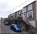
Houses set above street level, Rhiw Park Road, Abertillery
Built on a slope and accessed via steps, the houses are a couple of metres above the roadway.
Image: © Jaggery
Taken: 5 Mar 2014
0.09 miles
10
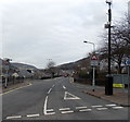
CCTV camera in Abertillery
Located high up on a post on the corner of Division Street and High Street. I wondered whether the camera is intended to monitor traffic, passers-by or both, and where its images are being viewed.
Image: © Jaggery
Taken: 5 Mar 2014
0.09 miles


