1
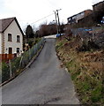
No through road, Penrhiwgarreg, Abertillery
Signs on the wall show 9-12 Penrhiwgarreg and No Through Road.
At about 280 metres (c920 ft) above sea level, this is one of the highest residential areas of Abertillery.
Image: © Jaggery
Taken: 5 Mar 2014
0.03 miles
2
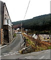
Up towards Penrhiwgarreg, Abertillery
The road ascends from Cwm Farm Lane towards Penrhiwgarreg. http://www.geograph.org.uk/photo/4002405
Image: © Jaggery
Taken: 5 Mar 2014
0.05 miles
3
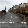
Junction of Cwm Farm Road and Pant-y-pwdyn Road, Abertillery
Cwm Farm Road http://www.geograph.org.uk/photo/4002460 is on the right.
Image: © Jaggery
Taken: 5 Mar 2014
0.06 miles
4
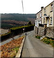
Western edge of Pant-y-Pwdyn Road allotments in Abertillery
Located in Penrhiwgarreg, one of the highest residential areas in Abertillery.
The land here is about 280 metres (more than 900 ft) above mean sea level.
Image: © Jaggery
Taken: 5 Mar 2014
0.06 miles
5
Pant-y-pwdyn Road, Abertillery
Looking towards the Cwm Farm Road junction.
Image: © Jaggery
Taken: 5 Mar 2014
0.06 miles
6
Up Cwm Farm Road towards Pant-y-pwdyn Road, Abertillery
The houses are in Pant-y-pwdyn Road.
Image: © Jaggery
Taken: 5 Mar 2014
0.07 miles
7
Cwm Farm Lane houses, Abertillery
Viewed from the corner of Cwm Farm Road.
Image: © Jaggery
Taken: 5 Mar 2014
0.07 miles
8
Give way ahead, Pant-y-pwdyn Road, Abertillery
Pant-y-pwdyn Road descends towards a triangular sign showing GIVE WAY at the Cwm Farm Road junction.
Image: © Jaggery
Taken: 5 Mar 2014
0.07 miles
9
Pant-y-pwdyn Road houses, Abertillery
Viewed from the corner of this http://www.geograph.org.uk/photo/4002488 lane.
Image: © Jaggery
Taken: 5 Mar 2014
0.07 miles
10
Cwm Farm Road, Abertillery
Looking ESE from the Pant-y-pwdyn Road junction.
Image: © Jaggery
Taken: 5 Mar 2014
0.08 miles


