1
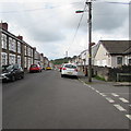
Cars and houses, Pengam Street, Glan-y-nant, Pengam
This part of Pengam Street is south of the Station Road junction.
Image: © Jaggery
Taken: 12 Aug 2019
0.07 miles
2
Pengam Street south of Station Road, Glan-y-nant, Pengam
On the right, Station Road https://www.geograph.org.uk/photo/6236328 leads to Pengam railway station.
Image: © Jaggery
Taken: 12 Aug 2019
0.07 miles
3
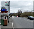
The A469 approaches the turn for Pengam railway station, Glan-y-nant
The sign shows left turn ahead for the station, where there are 170 Park & Ride parking spaces.
Image: © Jaggery
Taken: 3 May 2013
0.07 miles
4
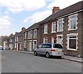
Pengam Street, Glan-y-nant
Looking SW from the corner of Station Road.
Image: © Jaggery
Taken: 1 May 2013
0.07 miles
5
A469 Cardiff Road at Glan-y-nant
Image: © Colin Pyle
Taken: 4 Jan 2018
0.08 miles
6
Up Hanbury Street, Pengam
Hanbury Street ascends away from Cardiff Road. Pengam Constitutional Club https://www.geograph.org.uk/photo/6245334 is on the right.
Image: © Jaggery
Taken: 23 Aug 2019
0.08 miles
7
Pengam Park & Ride parking area
Located on the east side of Pengam railway station. http://www.geograph.org.uk/photo/3450013
There are 170 parking spaces here, for use only by drivers catching the train at the station.
Image: © Jaggery
Taken: 1 May 2013
0.09 miles
8
Station Road, Glan-y-nant
Viewed from the edge of Pengam railway station http://www.geograph.org.uk/photo/3450013 looking along Station Road towards Pengam Street.
Image: © Jaggery
Taken: 1 May 2013
0.09 miles
9
Station Road in Glan-y-nant
Viewed from Pengam railway station looking along Station Road towards Pengam Street.
Image: © Jaggery
Taken: 17 Jul 2019
0.09 miles
10
Former Nazareth Chapel, Glan-y-nant
The Station Road building has been converted to secular, probably residential, use.
The chapel was an 1899 rebuild of the 1860 original.
Image: © Jaggery
Taken: 1 May 2013
0.10 miles


