1
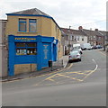
Pengam Street, Glan-y-nant, Pengam
A Victorian pillarbox https://www.geograph.org.uk/photo/6231369 is on the left.
Image: © Jaggery
Taken: 7 Aug 2019
0.01 miles
2
Car-lined Pengam Street, Glan-y-nant, Pengam
Viewed from the corner of Station Road in August 2019.
Image: © Jaggery
Taken: 12 Aug 2019
0.01 miles
3
Station Road, Glan-y-nant
Viewed from the edge of Pengam railway station http://www.geograph.org.uk/photo/3450013 looking along Station Road towards Pengam Street.
Image: © Jaggery
Taken: 1 May 2013
0.02 miles
4
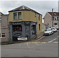
Pengam Street, Glan-y-nant, Pengam
Pengam Street ascends from the B4254. The Tuck Shop https://www.geograph.org.uk/photo/6231264 is on the left.
Image: © Jaggery
Taken: 7 Aug 2019
0.02 miles
5
Victorian pillarbox, Pengam Street, Glan-y-nant, Pengam
Located here. https://www.geograph.org.uk/photo/6231365
Image: © Jaggery
Taken: 7 Aug 2019
0.02 miles
6
Station Road in Glan-y-nant
Viewed from Pengam railway station looking along Station Road towards Pengam Street.
Image: © Jaggery
Taken: 17 Jul 2019
0.02 miles
7
Cars and houses, Station Road, Pengam
Viewed from Pengam railway station footbridge https://www.geograph.org.uk/photo/6231995 looking along Station Road towards Pengam Street.
Image: © Jaggery
Taken: 7 Aug 2019
0.03 miles
8
Former Nazareth Chapel, Glan-y-nant
The Station Road building has been converted to secular, probably residential, use.
The chapel was an 1899 rebuild of the 1860 original.
Image: © Jaggery
Taken: 1 May 2013
0.03 miles
9
Full 'o' Flavour, Glyn-y-nant
Takeaway food shop in Imperial Buildings, The Square, Glan-y-nant, on the corner of Pengam Street.
Image: © Jaggery
Taken: 1 May 2013
0.04 miles
10
Tuck Shop on a Glan-y-nant corner, Pengam
On the corner of The Square and Pengam Street viewed in August 2019.
Full 'o' Flavour https://www.geograph.org.uk/photo/3441839 was here in May 2013.
Image: © Jaggery
Taken: 7 Aug 2019
0.04 miles


