1
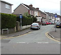
Old Vicarage Close, Fleur-de-lis
Cul-de-sac on the west side of Commercial Street.
Image: © Jaggery
Taken: 11 May 2018
0.02 miles
2
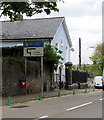
Cemetery in Fleur-de-Lys
No longer used for burials.
Image: © Mike Williams
Taken: 30 Dec 2019
0.02 miles
3
Wales & West Utilities van, Commercial Street, Fleur-de-lis
Wales & West Utilities was launched in 2005. The company website states
"Every day at Wales & West Utilities, our team of more than 1,300 skilled and dedicated colleagues do their very best to keep our 7.5 million customers safe and warm, with gas connections and a gas supply they can rely on combined with a level of service they can trust.
We don't sell gas. Instead we use our extensive pipeline to transport gas to homes and businesses throughout Wales and the southwest of England. This involves maintaining and replacing our gas pipe network, connecting new properties and responding to customer gas emergencies."
Image: © Jaggery
Taken: 11 May 2018
0.04 miles
4
Former Baptist Chapel, Pengam
This private residence was formerly Capel y Bont Welsh Baptist Church, built in 1857 and extended in 1865. Bont means bridge and the original chapel was sited near the bridge over the river Rhymney. The name was retained when the chapel was relocated to this site.
Image: © Robin Drayton
Taken: 31 Oct 2007
0.04 miles
5
West along Nydfa Road, Pengam
Towards River Terrace. One-way signs face Commercial Street.
Image: © Jaggery
Taken: 11 May 2018
0.04 miles
6
Unusually precise distance on a Commercial Street traffic sign, Pengam
The sign faces northbound traffic on the B4252 Commercial Street.
Faded in May 2018, the top part of the sign shows No Right Turn 317 yards ahead.
The green cones are intended to prevent vehicles parking near a school.
Capel-y-Bont https://www.geograph.org.uk/photo/5770920 is behind the sign.
Image: © Jaggery
Taken: 11 May 2018
0.04 miles
7
Capel-y-Bont, Commercial Street, Pengam
The Welsh text on the tablet shows that Capel-y-Bont Baptist Chapel was built
in 1857, rebuilt in 1865. The chapel was converted to residential use in 1997.
Image: © Jaggery
Taken: 11 May 2018
0.05 miles
8
Converted former Baptist Chapel, Commercial Street, Pengam
The Welsh text on the tablet shows that Capel-y-Bont Baptist Chapel was built
in 1857, rebuilt in 1865. The chapel was converted to residential use in 1997.
The house is named Capel-y-Bont.
Image: © Jaggery
Taken: 11 May 2018
0.05 miles
9
Green cones at the edge of Bont Close and Commercial Street, Pengam
The green cones are intended to prevent vehicles parking near a school.
They shouldn't be necessary on the camera (Bont Close) side of the junction
because the double yellow lines indicate no parking at any time.
The former Baptist chapel, now a house named Capel-y-Bont, is on the right. https://www.geograph.org.uk/photo/5770920
Image: © Jaggery
Taken: 11 May 2018
0.06 miles
10
Bont Close bungalows, Pengam
Cul-de-sac on the east side of Commercial Street.
Image: © Jaggery
Taken: 11 May 2018
0.06 miles


