1
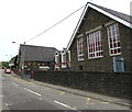
Ysgol Gymraeg Trelyn, Pengam
Welsh medium primary school on the west side of Commercial Street.
Image: © Jaggery
Taken: 11 May 2018
0.01 miles
2
Ordnance Survey Cut Mark
This OS cut mark can be found on the west face of the school. It marks a point 139.815m above mean sea level.
Image: © Adrian Dust
Taken: 12 Feb 2021
0.01 miles
3
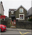
Entrance to Ysgol Gymraeg Trelyn, Pengam
From Commercial Street. Ysgol Gymraeg Trelyn is a Welsh medium primary school.
Image: © Jaggery
Taken: 11 May 2018
0.01 miles
4
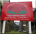
Ysgol Gymraeg Trelyn name sign, Pengam
On the left here. https://www.geograph.org.uk/photo/5769871 The Welsh Cymraeg yw Iaith ein Taith means Welsh is the Language of our Journey.
Image: © Jaggery
Taken: 11 May 2018
0.01 miles
5
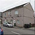
150 and 150A Commercial Street, Pengam
The house numbers in May 2018 suggest that this was formerly one house which has been subdivided.
Image: © Jaggery
Taken: 11 May 2018
0.02 miles
6
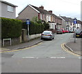
Row of houses on the east side of Commercial Street, Pengam
The sign on the left is on the corner of Islwyn Close. https://www.geograph.org.uk/photo/5769780
Image: © Jaggery
Taken: 11 May 2018
0.02 miles
7
Northern end of Commercial Street, Pengam
Viewed from High Street looking south towards the Smiths Arms. http://www.geograph.org.uk/photo/3440269 The sign on the right pointing along Commercial Street (the B4252) shows ½ mile to Fleur-de-Lys and 1 mile to Maesycwmmer.
Image: © Jaggery
Taken: 1 May 2013
0.04 miles
8
Byelaws notice, Islwyn Close, Pengam
The notice is headed ISLWYN BOROUGH COUNCIL BYELAWS, viewed in May 2018.
The Borough of Islwyn was one of five local government districts of Gwent from 1974 to 1996.
The borough was abolished in 1996 when its area became part of Caerphilly County Borough.
Image: © Jaggery
Taken: 11 May 2018
0.04 miles
9
Smiths Arms, Pengam
Pub in Commercial Street near its northern end at the High Street junction.
Image: © Jaggery
Taken: 1 May 2013
0.04 miles
10
West along Nydfa Road, Pengam
Towards River Terrace. One-way signs face Commercial Street.
Image: © Jaggery
Taken: 11 May 2018
0.05 miles


