IMAGES TAKEN NEAR TO
Fleur De Lis, BLACKWOOD, NP12 3SH
Introduction
This page details the photographs taken nearby to NP12 3SH by members of the Geograph project.
The Geograph project started in 2005 with the aim of publishing, organising and preserving representative images for every square kilometre of Great Britain, Ireland and the Isle of Man.

There are currently over 7.5m images from over14,400 individuals and you can help contribute to the project by visiting https://www.geograph.org.uk
Image Map
Images are licensed for reuse under creativecommons.org/licenses/by-sa/2.0
Notes
- Clicking on the map will re-center to the selected point.
- The higher the marker number, the further away the image location is from the centre of the postcode.
Image Listing (101 Images Found)
Images are licensed for reuse under creativecommons.org/licenses/by-sa/2.0
Image
Details
Distance
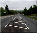
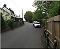
1
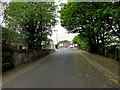
Up Bryngwyn Street, Fleur-de-lis
From the southwest side of the A4049, Bryngwyn Street ascends towards Gellihaf Road.
Image: © Jaggery
Taken: 16 May 2018
0.01 miles
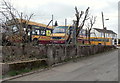
2
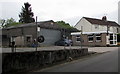
Harris Coaches office, Bryngwyn Street, Fleur-de-lis
The single-storey office on the right is in the southwest corner of the Harris Coaches depot.
Image: © Jaggery
Taken: 16 May 2018
0.01 miles
3
Up Bryngwyn Street, Fleur-de-lis
Bryngwyn Street ascends from Gellihaf Road towards the A4049 out of shot 150 metres from the camera.
Image: © Jaggery
Taken: 16 May 2018
0.02 miles
4
Path from the west side of the A4049, Fleur-de-lis
Towards Bryngwyn Street.
Image: © Jaggery
Taken: 16 May 2018
0.02 miles
5
Harris coaches, Fleur de Lys
The coaches are inside the Harris Coaches Fleur de Lys depot. http://www.geograph.org.uk/photo/3444389
Fleur de Lys is a village adjacent to Pengam, to the SE of Blackwood.
Image: © Jaggery
Taken: 3 May 2013
0.02 miles
6
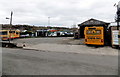
Harris Coaches Fleur de Lys depot
The coach depot is alongside Bryngwyn Street, between the A4049 and Gellihaf Road.
Fleur de Lys is a village adjacent to Pengam, to the SE of Blackwood.
Image: © Jaggery
Taken: 3 May 2013
0.02 miles
7
Down the A4049, Fleur-de-lis
North along the A4049 towards Pengam.
Image: © Jaggery
Taken: 16 May 2018
0.03 miles
8
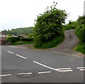
Side road in Fleur-de-lis
Ascending from Bryngwyn Street towards the backs of Gellihaf Road houses.
Image: © Jaggery
Taken: 16 May 2018
0.03 miles
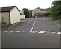
9
Towards the southeast end of Gellihaf Road, Fleur-de-lis
Out of shot ahead, Gellihaf Road ends at the A4049 junction.
Image: © Jaggery
Taken: 16 May 2018
0.03 miles
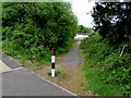
10
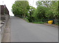
Yellow grit/salt box, Gellihaf Road, Fleur-de-lis
Alongside the long ascent from the centre of Fleur-de-lis.
Image: © Jaggery
Taken: 16 May 2018
0.04 miles