1
Solar panels, Bryn Road, Blackwood
The recently-built houses all have solar panels on their roof.
Image: © Jaggery
Taken: 3 May 2013
0.02 miles
2
Bryn Rd, Blackwood, at the junction with Gordon Rd
Image: © John Lord
Taken: 23 Aug 2017
0.05 miles
3
Bryn Road, Blackwood
Approaching the B4254.
Image: © Robin Drayton
Taken: 20 Apr 2011
0.09 miles
4
Mormon church, Bryn Road, Blackwood
Image: © Roger Cornfoot
Taken: 10 May 2007
0.09 miles
5
Barrier blocking a lane from Blackwood to Bryn
Viewed from the south side of the B4254 at the edge of Blackwood. The lane http://www.geograph.org.uk/photo/3443238 leads to the area name Bryn near Pontllanfraith. Though the barrier prevents vehicular access, pedestrians can access the lane via the gap between the barrier and a boulder on the left.
Image: © Jaggery
Taken: 3 May 2013
0.10 miles
6
Western end of Highfields Way, Blackwood
Highfields Way heads away from the roundabout at the Bryn Road junction.
Image: © Jaggery
Taken: 3 May 2013
0.13 miles
7
Lane from Blackwood to Bryn
A barrier http://www.geograph.org.uk/photo/3443234 a few metres behind the camera prevents vehicles accessing the lane.
Image: © Jaggery
Taken: 3 May 2013
0.13 miles
8
B4254 Bryn Road, Blackwood
Image: © Colin Pyle
Taken: 4 Jan 2018
0.15 miles
9
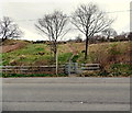
Kissing gate, Fleur de Lys
The kissing gate on the north side of the B4254 leads to a track at the edge of Fleur de Lys,
a village adjacent to Pengam, to the SE of Blackwood.
Image: © Jaggery
Taken: 3 May 2013
0.16 miles
10
School rugby pitches, Fleur de Lys
Viewed from the B4254. The rugby pitches are on the east side of the school buildings in Ysgol Gyfun Cwm Rhymni. Fleur de Lys is a village adjacent to Pengam, to the SE of Blackwood.
Image: © Jaggery
Taken: 3 May 2013
0.17 miles


