1
Woodland Road houses, Springfield, Pontllanfraith
Houses on the north side of Woodland Road viewed from the Millbrook Road and Mill Road crossroads.
Image: © Jaggery
Taken: 8 Aug 2012
0.03 miles
2
Mussel White Court, Springfield, Pontllanfraith
Mussel White Court is a small cul-de-sac of 14 houses, viewed from Millbrook Road.
Image: © Jaggery
Taken: 8 Aug 2012
0.05 miles
3
Islwyn Terrace, Pontllanfraith
Islwyn Terrace is a separately-named part of Llanarth Road.
Image: © Jaggery
Taken: 8 Aug 2012
0.05 miles
4
Disused grandstand, Islwyn Park, Pontllanfraith
Islwyn Park is the home ground of Pontllanfraith Rugby Football Club.
The grandstand is located in the SE corner of the park. A notice on the side wall of the grandstand shows DANGEROUS STRUCTURE KEEP OUT.
Image: © Jaggery
Taken: 8 Aug 2012
0.06 miles
5
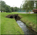
Nant Brynar, Islwyn Park, Pontllanfraith
A stream, Nant Brynar, enters a twin-bore culvert under the entrance road into Islwyn Park.
Nant Brynar is a tributary of the Sirhowy, into which it flows about 200 metres ahead.
Image: © Jaggery
Taken: 8 Aug 2012
0.06 miles
6
St John Ambulance Hall, Llanarth Road, Pontllanfraith
Located in a locked enclosure a few metres north of the Woodland Road junction.
Image: © Jaggery
Taken: 8 Aug 2012
0.06 miles
7
Islwyn Park, Llanarth Road, Pontllanfraith
The eastern edge of Islwyn Park and its entrance from Llanarth Road in the background. The narrow road leads from the bowling green and from industrial premises outside the park.
Image: © M J Roscoe
Taken: 2 Jan 2016
0.07 miles
8
Former Pont Pet Supplies premises to let, Pontllanfraith
There is a To Let sign on the shop on the corner of Meadow Road and Llanarth Road.
An earlier occupier of the premises was Llanarth Stores, newsagents and general stores.
Image: © Jaggery
Taken: 8 Aug 2012
0.07 miles
9
Rugby pitch, Islwyn Park, Pontllanfraith
This is the home ground of Pontllanfraith Rugby Football Club.
A disused grandstand http://www.geograph.org.uk/photo/3073987 is on the left.
Image: © Jaggery
Taken: 8 Aug 2012
0.08 miles
10
Mill Road, Springfield, Pontllanfraith
Viewed from Millbrook Road at the Woodland Road crossroads.
Image: © Jaggery
Taken: 8 Aug 2012
0.08 miles


