1
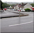
Pontllanfraith Methodist Church
Built on a hillside overlooking the Sirhowy Valley.
Image: © Robin Drayton
Taken: 26 May 2011
0.01 miles
2
Ordnance Survey Flush Bracket (S1341)
This OS Flush Bracket can be found on the SW face of the Methodist Chapel. It marks a point 142.709m above mean sea level.
Image: © Adrian Dust
Taken: 22 Jun 2019
0.01 miles
3
Bend in the B4251, Pontllanfraith
North along the B4251 Commercial Street from the corner of Gelligroes Road.
Image: © Jaggery
Taken: 20 Jun 2018
0.02 miles
4
Bryntirion Dental Surgery, Pontllanfraith
Located at the northern end of Sir Ivor's Road, close to the Commercial Street roundabout.
Image: © Jaggery
Taken: 23 Jan 2011
0.02 miles
5
Ex Servicemen's Club
On the small section of dual carriageway in Pontllanfraith.
Image: © Stuart Wilding
Taken: 11 Mar 2007
0.03 miles
6
Road junction and small roundabout, Pontllanfraith
The junction of Commercial Street with Sir Ivors Road.
Image: © Robin Drayton
Taken: 26 May 2011
0.04 miles
7
Older and newer housing, Commercial Street, Pontllanfraith
Newer housing (Plaza Court) on the left, older on the right.
Image: © Jaggery
Taken: 20 Jan 2011
0.05 miles
8
Tregaron Court, Pontllanfraith
A Commercial Street building containing several flats to rent.
Image: © Jaggery
Taken: 20 Jan 2011
0.05 miles
9
Lewis Memorials and Mototec, Pontllanfraith
Monumental masons premises on Commercial Street.
Next door is Mototec, specialists in computerised wheel alignment and chassis diagnostics, brakes, steering and suspension.
Image: © Jaggery
Taken: 20 Jan 2011
0.05 miles
10
Entrance to St Augustine's church, Pontllanfraith
Viewed from the edge of Commercial Street. The entrance and car park are on the SW side of the church of St Augustine, Rectorial Benefice of Mynyddislwyn, Church in Wales.
Image: © Jaggery
Taken: 23 Jan 2011
0.05 miles


