1
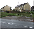
Semis above Newport Road, Pontllanfraith
Semi-detached houses above the west side of the B4251 Newport Road.
Image: © Jaggery
Taken: 20 Jun 2018
0.02 miles
2
Overdene, Pontllanfraith
Cul-de-sac viewed across Gelli Lane.
Image: © Jaggery
Taken: 20 Jun 2018
0.05 miles
3
Pedestrian refuge, Newport Road, Pontllanfraith
Walkers can use the refuge to cross half a road width at a time when traffic is busy on the B4251 Newport Road.
Image: © Jaggery
Taken: 20 Jun 2018
0.05 miles
4
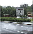
Gelligroes Roundabout direction sign, Pontllanfraith
Facing southbound traffic on the B4251 Newport Road 150 metres from the roundabout.
Image: © Jaggery
Taken: 20 Jun 2018
0.06 miles
5
Welcome to Hawker Siddeley Switchgear, Pontllanfraith
The Welcome sign faces the B4251 Newport Road.
Image: © Jaggery
Taken: 20 Jun 2018
0.06 miles
6
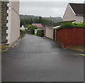
Side road from Gelligroes Road towards Overdene, Pontllanfraith
A Western Power Distribution electricity substation https://www.geograph.org.uk/photo/5820474 is behind the hedge on the right.
Image: © Jaggery
Taken: 20 Jun 2018
0.06 miles
7
Rooftop solar panels on a Pontllanfraith corner
On the corner of Overdene and Gelli Lane.
Image: © Jaggery
Taken: 20 Jun 2018
0.06 miles
8
Sirhowy Valley Walk, Pontllanfraith (2)
The footpath here follows the route of a former tram road alongside factory premises. It is bordered by a security fence on one side and woodland on the other.
Image: © M J Roscoe
Taken: 18 Nov 2016
0.06 miles
9
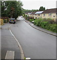
NNW along Gelli Lane, Pontllanfraith
Viewed from the corner of Marshfield Court.
Image: © Jaggery
Taken: 20 Jun 2018
0.07 miles
10
Overdene bus stop, Gelli Lane, Pontllanfraith
Located alongside Gelli Lane 50 metres from the corner of Overdene, https://www.geograph.org.uk/photo/5814262
in June 2018 this stop is on bus route 6 from Blackwood bus station to Wyllie.
Image: © Jaggery
Taken: 20 Jun 2018
0.07 miles


