1
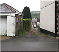
Lane towards the B4251 in Pontllanfraith
From the east side of Gelligroes Road.
Image: © Jaggery
Taken: 20 Jun 2018
0.01 miles
2
Pen-llwyn Avenue, Pontllanfraith
Residential street viewed from the top of the steps in
Image The 'No Entry' signs are at a cross roads.
Image: © M J Roscoe
Taken: 22 Sep 2016
0.03 miles
3
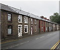
Houses on the east side of Sir Ivors Road, Pontllanfraith
Sir Ivors Road is the name used on the local council's website.
Maps also show Sir Ivor Road and Sir Ivor's Road.
Image: © Jaggery
Taken: 20 Jun 2018
0.03 miles
4
Side road towards Newport Road, Pontllanfraith
From Gelligroes Road to the B4251 Newport Road.
Image: © Jaggery
Taken: 20 Jun 2018
0.03 miles
5
Start of the 40 zone on the B4251, Pontllanfraith
The speed limit increases from 30mph to 40mph.
Image: © Jaggery
Taken: 20 Jun 2018
0.03 miles
6
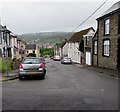
Down Penllwyn Avenue, Pontllanfraith
One-way Penllwyn Avenue descends towards the B4251 Sir Ivors Road, the name used on the local council's website. Maps also show Sir Ivor Road and Sir Ivor's Road.
Image: © Jaggery
Taken: 20 Jun 2018
0.03 miles
7
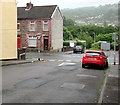
Junction of Penllwyn Avenue and Sir Ivors Road, Pontllanfraith
Penllwyn Avenue descends towards the B4251 Sir Ivors Road, the name used on the local council's website.
Maps also show Sir Ivor Road and Sir Ivor's Road.
Image: © Jaggery
Taken: 20 Jun 2018
0.03 miles
8
Colin's Fish Bar and Pont News, Pontllanfraith
Two Commercial Street shops, a few tens of metres north of the Tredegar Junction pub. http://www.geograph.org.uk/photo/2240052
http://www.geograph.org.uk/photo/361605 to an interesting side view of Colin's Fish Bar.
Image: © Jaggery
Taken: 20 Jan 2011
0.04 miles
9
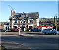
Tredegar Junction pub, Pontllanfraith
Located at the southern end of Commercial Street, Pontllanfraith.
The name of the pub is a reminder that there were formerly two railway stations nearby, Pontllanfraith Low Level and Pontllanfraith High Level. Both were closed in the 1960s.
A small Ladbrokes betting office adjoins the right side of the pub.
Image: © Jaggery
Taken: 20 Jan 2011
0.04 miles
10
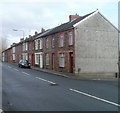
Pontllanfraith : Sir Ivor's Road houses north of Penllwyn Avenue
Houses on the east side of the road, viewed from the corner of Penllwyn Avenue.
Image: © Jaggery
Taken: 23 Jan 2011
0.04 miles


