IMAGES TAKEN NEAR TO
The Glade, BLACKWOOD, NP12 2HB

Introduction

This page details the photographs taken nearby to The Glade, NP12 2HB by members of the Geograph project.

The Geograph project started in 2005 with the aim of publishing, organising and preserving representative images for every square kilometre of Great Britain, Ireland and the Isle of Man.

There are currently over 7.5m images from over14,400 individuals and you can help contribute to the project by visiting https://www.geograph.org.uk

Image Map


Images are licensed for reuse under creativecommons.org/licenses/by-sa/2.0
Notes
  • Clicking on the map will re-center to the selected point.
  • The higher the marker number, the further away the image location is from the centre of the postcode.

Image Listing (37 Images Found)

Images are licensed for reuse under creativecommons.org/licenses/by-sa/2.0
  • ...
Image
Details
Distance
1
NCN Route 47 near Wyllie
Image: © Gareth James Taken: 27 Mar 2011
0.02 miles
2
Old railway walk, Wyllie
Part of the Sirhowy Valley Country Park.
Image: © Roger Cornfoot Taken: 10 May 2007
0.03 miles
3
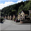
The Glade, Wyllie
Modern houses at the southern edge of the village. This was formerly the location of the old coal tip from Wyllie Colliery.
Image: © Jaggery Taken: 24 Sep 2018
0.04 miles
4
Former railway underpass south of Wyllie
A path from Wyllie towards Ynysddu passes under a bridge which formerly carried a railway through the Sirhowy Valley.
Image: © Jaggery Taken: 24 Sep 2018
0.05 miles
5
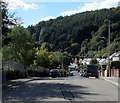
Wooded hillside view, Wyllie
Looking to the southwest from Glanhowy Road in Wyllie.
Image: © Jaggery Taken: 24 Sep 2018
0.06 miles
6
River Sirhowy below Wyllie
Looking upstream on a rainy day from footbridge Image
Image: © M J Roscoe Taken: 18 Nov 2016
0.07 miles
7
Footbridge, River Sirhowy, below Wyllie
The bridge is on a public footpath joining Newport Road to Glanhowy Road, Wyllie. The streetlight is illuminated!
Image: © M J Roscoe Taken: 18 Nov 2016
0.07 miles
8
Sirhowy River footbridge south of Wyllie
The bridge carries a path from Wyllie towards Ynysddu over the Sirhowy. https://www.geograph.org.uk/photo/5920967
Image: © Jaggery Taken: 24 Sep 2018
0.08 miles
9
Sirhowy valley and wooded hillside north of Ynysddu
Viewed from Newport Road.
Image: © Jaggery Taken: 7 Apr 2011
0.09 miles
10
Downstream along the Sirhowy south of Wyllie
The Sirhowy River flows south away from this https://www.geograph.org.uk/photo/5920964 footbridge.
Image: © Jaggery Taken: 24 Sep 2018
0.09 miles
  • ...