1
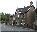
Penmaen Road houses near a new section of the B4251
Residents of this row of houses have a somewhat quieter existence since the course of the B4251 was moved a few metres to the east, along this http://www.geograph.org.uk/photo/3074149 recently-built road.
Image: © Jaggery
Taken: 8 Aug 2012
0.04 miles
2
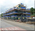
Riverside House, Pontllanfraith
Distinctive detached house in Penmaen Road.
Image: © Jaggery
Taken: 8 Aug 2012
0.04 miles
3
Woodfieldside Business Park, Pontllanfraith
Viewed from the entrance road from Penmaen Road.
The business units were partly funded through the European Objective 1 Programme and the Local Regeneration Fund via the Welsh Government. The business park contains 22 business units, designed for light industrial use.
Image: © Jaggery
Taken: 8 Aug 2012
0.07 miles
4
Pontllanfraith Primary School
Viewed across Penmaen Road. The Infants part of the school is on the right.
Image: © Jaggery
Taken: 8 Aug 2012
0.08 miles
5
No pedestrians ahead on the B4251, Pontllanfraith
This recently-built section of road has no provision for pedestrians,
who are forbidden to proceed beyond the red-edged circular signs.
Pedestrians can use the old course of Penmaen Road nearby.
Image: © Jaggery
Taken: 8 Aug 2012
0.09 miles
6
Riverside Garage, Penmaen Road, Pontllanfraith
Premises of John Kajzer-Hughes & Son Ltd, located opposite Pontllanfraith Primary School. http://www.geograph.org.uk/photo/3074110
The river that Riverside Garage is beside is the Sirhowy.
Image: © Jaggery
Taken: 8 Aug 2012
0.10 miles
7
Sirhowy Valley Walk, Pontllanfraith
This is the long distance path going north from the end of the garage complex off Commercial Road. The dog faeces bin could have been better placed!
Image: © M J Roscoe
Taken: 2 Jan 2016
0.11 miles
8
Footpath to Blackwood Road, Pontllanfraith
Footpath from the Sirhowy Valley Walk towards Health Centre and former Islwyn Council Offices.
Image: © M J Roscoe
Taken: 2 Jan 2016
0.11 miles
9
Stagecoach depot, Pontllanfraith
Located on the corner of Penmaen Road and the B4254, this was formerly the depot and offices of Islwyn Borough Transport, which provided bus services in Blackwood and surrounding areas from 1974 to 2010.
Image: © Jaggery
Taken: 8 Aug 2012
0.14 miles
10
House construction, Nant y coed, Pontllanfraith
Part of a Charles Church construction site located opposite recently-built houses
in Maes-yr-afon and Pleasant Close. http://www.geograph.org.uk/photo/3074372
Image: © Jaggery
Taken: 8 Aug 2012
0.15 miles


