IMAGES TAKEN NEAR TO
Hill View, BLACKWOOD, NP12 2EH

Introduction

This page details the photographs taken nearby to Hill View, NP12 2EH by members of the Geograph project.

The Geograph project started in 2005 with the aim of publishing, organising and preserving representative images for every square kilometre of Great Britain, Ireland and the Isle of Man.

There are currently over 7.5m images from over14,400 individuals and you can help contribute to the project by visiting https://www.geograph.org.uk

Image Map


Images are licensed for reuse under creativecommons.org/licenses/by-sa/2.0
Notes
  • Clicking on the map will re-center to the selected point.
  • The higher the marker number, the further away the image location is from the centre of the postcode.

Image Listing (15 Images Found)

Images are licensed for reuse under creativecommons.org/licenses/by-sa/2.0
Image
Details
Distance
1
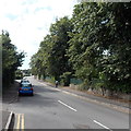
Penllwyn Lane, Pontllanfraith
Penllwyn Lane heads SW away from Blackwood Road.
Image: © Jaggery Taken: 22 Aug 2013
0.19 miles
2
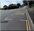
Penllwyn Lane bus stops, Pontllanfraith
The bus stops are opposite Brynteg Avenue. http://www.geograph.org.uk/photo/3615792 Pontllanfraith Comprehensive School is nearby.
Image: © Jaggery Taken: 22 Aug 2013
0.19 miles
3
Sacred Heart RC Church
Sacred Heart Roman Catholic Church in Pontllanfraith, with churchyard flowers adding some colour on rainy afternoon. The white-painted window surrounds give the church an attractive appearance.
Image: © David Roberts Taken: 20 Apr 2008
0.21 miles
4
Wat Will Motor Company, Pontllanfraith
Used car premises located on the corner of Blackwood Road and Brynhyfryd Street, Pontllanfraith.
Image: © Jaggery Taken: 20 Jan 2011
0.21 miles
5
Brynteg Avenue, Pontllanfraith
Houses on the east side of Brynteg Avenue, viewed across Penllwyn Lane.
Image: © Jaggery Taken: 22 Aug 2013
0.22 miles
6
Line of trees by playing field, Pontllanfraith Leisure Centre
Oak trees.
Image: © M J Roscoe Taken: 2 Nov 2021
0.22 miles
7
Brynhyfryd St, Blackwood
Image: © John Lord Taken: 24 Aug 2017
0.23 miles
8
House in Blackwood Rd, Pontllanfraith
The date 1893 is prominently displayed in the brickwork panel above the door.
Image: © John Lord Taken: 24 Aug 2017
0.24 miles
9
Ordnance Survey Flush Bracket (S1340)
This OS Flush Bracket can be found on the SW face of the RC Church. It marks a point 156.323m above mean sea level.
Image: © Adrian Dust Taken: 22 Jun 2019
0.24 miles
10
The former Mynyddislwyn Urban District Council Offices
Image: © John Lord Taken: 24 Aug 2017
0.24 miles