1
No pedestrians ahead on the B4251, Pontllanfraith
This recently-built section of road has no provision for pedestrians,
who are forbidden to proceed beyond the red-edged circular signs.
Pedestrians can use the old course of Penmaen Road nearby.
Image: © Jaggery
Taken: 8 Aug 2012
0.06 miles
2
Stagecoach depot, Pontllanfraith
Located on the corner of Penmaen Road and the B4254, this was formerly the depot and offices of Islwyn Borough Transport, which provided bus services in Blackwood and surrounding areas from 1974 to 2010.
Image: © Jaggery
Taken: 8 Aug 2012
0.08 miles
3
Sirhowy Enterprise Way heads out of Blackwood
Sirhowy Enterprise Way passes the grey back of a Blackwood boundary sign and crosses the bridge over the Sirhowy River. http://www.geograph.org.uk/photo/3615975
Image: © Jaggery
Taken: 22 Aug 2013
0.09 miles
4
Pleasant Close, Pontllanfraith
Recently-built houses located opposite a Charles Church development of new houses in Nant y Coed.
Image: © Jaggery
Taken: 8 Aug 2012
0.09 miles
5
Weirs, River Sirhowy, Pontllanfraith
The upper weir is the purpose built weir in
Image, whereas the lower weir appears to be more casual, perhaps only apparent when the river is in spate as here.
Image: © M J Roscoe
Taken: 2 Jan 2016
0.09 miles
6
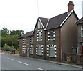
Penmaen Road houses near a new section of the B4251
Residents of this row of houses have a somewhat quieter existence since the course of the B4251 was moved a few metres to the east, along this http://www.geograph.org.uk/photo/3074149 recently-built road.
Image: © Jaggery
Taken: 8 Aug 2012
0.09 miles
7
Weir, River Sirhowy, Pontllanfraith
Taken just after heavy rains from the path on the eastern bank.
Image: © M J Roscoe
Taken: 2 Jan 2016
0.09 miles
8
Sirhowy Valley Walk, Penmaen Industrial Estate
The long distance path runs here between the light industrial estate and the River Sirhowy.
Image: © M J Roscoe
Taken: 2 Jan 2016
0.09 miles
9
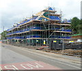
House construction, Nant y coed, Pontllanfraith
Part of a Charles Church construction site located opposite recently-built houses
in Maes-yr-afon and Pleasant Close. http://www.geograph.org.uk/photo/3074372
Image: © Jaggery
Taken: 8 Aug 2012
0.11 miles
10
Riverside House, Pontllanfraith
Distinctive detached house in Penmaen Road.
Image: © Jaggery
Taken: 8 Aug 2012
0.11 miles


