IMAGES TAKEN NEAR TO
Blackwood Road, BLACKWOOD, NP12 2BR
Introduction
This page details the photographs taken nearby to Blackwood Road, NP12 2BR by members of the Geograph project.
The Geograph project started in 2005 with the aim of publishing, organising and preserving representative images for every square kilometre of Great Britain, Ireland and the Isle of Man.

There are currently over 7.5m images from over14,400 individuals and you can help contribute to the project by visiting https://www.geograph.org.uk
Image Map
Images are licensed for reuse under creativecommons.org/licenses/by-sa/2.0
Notes
- Clicking on the map will re-center to the selected point.
- The higher the marker number, the further away the image location is from the centre of the postcode.
Image Listing (104 Images Found)
Images are licensed for reuse under creativecommons.org/licenses/by-sa/2.0
Image
Details
Distance
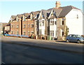
1
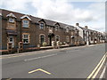
Houses in Blackwood Rd, Pontllanfraith
Each house has the date 1893 above the door.
Image: © John Lord
Taken: 24 Aug 2017
0.00 miles
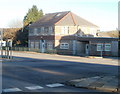
2
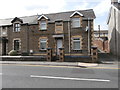
House in Blackwood Rd, Pontllanfraith
The date 1893 is prominently displayed in the brickwork panel above the door.
Image: © John Lord
Taken: 24 Aug 2017
0.02 miles
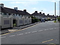
3
Semi-detached houses, Blackwood Road, Pontllanfraith
The houses are in the NE of Pontllanfraith near the Blackwood boundary.
Image: © Jaggery
Taken: 22 Aug 2013
0.03 miles
4
Brynteg Avenue, Pontllanfraith
Houses on the east side of Brynteg Avenue, viewed across Penllwyn Lane.
Image: © Jaggery
Taken: 22 Aug 2013
0.05 miles
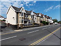
5
Older and newer housing, Commercial Street, Pontllanfraith
Newer housing (Plaza Court) on the left, older on the right.
Image: © Jaggery
Taken: 20 Jan 2011
0.06 miles
6
Tregaron Court, Pontllanfraith
A Commercial Street building containing several flats to rent.
Image: © Jaggery
Taken: 20 Jan 2011
0.06 miles
7
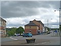
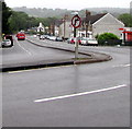
Road junction and small roundabout, Pontllanfraith
The junction of Commercial Street with Sir Ivors Road.
Image: © Robin Drayton
Taken: 26 May 2011
0.06 miles
8
Penllwyn Lane, Pontllanfraith
Penllwyn Lane heads SW away from Blackwood Road.
Image: © Jaggery
Taken: 22 Aug 2013
0.07 miles
9
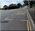
Penllwyn Lane bus stops, Pontllanfraith
The bus stops are opposite Brynteg Avenue. http://www.geograph.org.uk/photo/3615792 Pontllanfraith Comprehensive School is nearby.
Image: © Jaggery
Taken: 22 Aug 2013
0.07 miles
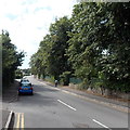
10
Bend in the B4251, Pontllanfraith
North along the B4251 Commercial Street from the corner of Gelligroes Road.
Image: © Jaggery
Taken: 20 Jun 2018
0.07 miles