IMAGES TAKEN NEAR TO
Brynhyfryd Street, BLACKWOOD, NP12 2AT

Introduction

This page details the photographs taken nearby to Brynhyfryd Street, NP12 2AT by members of the Geograph project.

The Geograph project started in 2005 with the aim of publishing, organising and preserving representative images for every square kilometre of Great Britain, Ireland and the Isle of Man.

There are currently over 7.5m images from over14,400 individuals and you can help contribute to the project by visiting https://www.geograph.org.uk

Image Map


Images are licensed for reuse under creativecommons.org/licenses/by-sa/2.0
Notes
  • Clicking on the map will re-center to the selected point.
  • The higher the marker number, the further away the image location is from the centre of the postcode.

Image Listing (58 Images Found)

Images are licensed for reuse under creativecommons.org/licenses/by-sa/2.0
  • ...
Image
Details
Distance
1
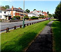
Brynhyfryd St, Blackwood
Image: © John Lord Taken: 24 Aug 2017
0.02 miles
2
Wat Will Motor Company, Pontllanfraith
Used car premises located on the corner of Blackwood Road and Brynhyfryd Street, Pontllanfraith.
Image: © Jaggery Taken: 20 Jan 2011
0.04 miles
3
Blackwood Road houses, Pontllanfraith
These houses, alongside the A4048 near the northern edge of Pontllanfraith, are set a couple of metres above road level.
Image: © Jaggery Taken: 20 Jan 2011
0.05 miles
4
Path from Pontllanfraith to Blackwood
Alongside Blackwood Road in Pontllanfraith, approaching the Blackwood boundary.
Image: © Jaggery Taken: 22 Aug 2013
0.07 miles
5
Ordnance Survey Cut Mark
This OS cut mark can be found on the old school wall at the road junction. It marks a point 156.546m above mean sea level.
Image: © Adrian Dust Taken: 22 Jun 2019
0.08 miles
6
Approach to Pontllanfraith House
Image: © John Lord Taken: 24 Aug 2017
0.08 miles
7
Remembrance - war memorial and bed of poppies
Pontllanfraith war memorial, a cenotaph of grey granite, opposite the site of former council offices Image There is a similar bed of red poppies on the other side of the approach to the memorial.
Image: © M J Roscoe Taken: 4 Jun 2019
0.09 miles
8
Pontllanfraith House
Caerphilly County Borough Council offices located on the east side of Blackwood Road, Pontllanfraith. In the centre of the view is Pontllanfraith War Memorial.
Image: © Jaggery Taken: 20 Jan 2011
0.10 miles
9
Playing field, Pontllanfraith Leisure Centre
Next to the flat field is Blackwood Police Station. The pylon of Chartist Bridge is beyond.
Image: © M J Roscoe Taken: 2 Nov 2021
0.10 miles
10
Pond, Sir Harold Finch Memorial Park, Pontllanfraith
The pond, next to a footpath, is close to the former Civic Centre, and on the edge of a hay meadow (right).
Image: © M J Roscoe Taken: 1 Sep 2016
0.10 miles
  • ...