1
Gilwern House care home, Pontllanfraith
Privately-owned care home accommodating 13 residents, located on Newbridge Road.
Image: © Jaggery
Taken: 16 Aug 2010
0.05 miles
2
Modern flats, Newbridge Road, Pontllanfraith
Located on the south side of the road, opposite Sainsbury's. http://www.geograph.org.uk/photo/2016911
Image: © Jaggery
Taken: 16 Aug 2010
0.05 miles
3
Ordnance Survey Flush Bracket (S9918)
This OS Flush Bracket can be found on Gilwern House. It marks a point 157.286m above mean sea level.
Image: © Adrian Dust
Taken: 9 Feb 2021
0.06 miles
4
SE end of Sirhowy Enterprise Way, Pontllanfraith
The view NW along the A4048 from the edge of a roundabout.
Sirhowy Enterprise Way gives a direct route from the north of Blackwood to the east of Pontllanfraith, and also to Oakdale Business Park, on the site of the former Oakdale Colliery.
Image: © Jaggery
Taken: 23 Jan 2011
0.07 miles
5
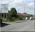
Pontllanfraith boundary sign
Shaded by trees, a green sign asks you to please drive carefully in Pontllanfraith.
Behind the trees is a Sainsbury's superstore. http://www.geograph.org.uk/photo/2016911 Behind the camera are newly-built flats.
http://www.geograph.org.uk/photo/2016947
Image: © Jaggery
Taken: 16 Aug 2010
0.07 miles
6
Sainsbury's Pontllanfraith
The superstore opened in 2009 on a site on the north side of Newbridge Road formerly occupied by a Somerfield store.
Image: © Jaggery
Taken: 16 Aug 2010
0.07 miles
7
Perimeter road, Sainsbury's, Pontllanfraith
The road, on the southern edge of the Newbridge Road site, leads from the superstore to the filling station http://www.geograph.org.uk/photo/2016897 and exit.
Image: © Jaggery
Taken: 16 Aug 2010
0.07 miles
8
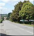
Newbridge Road heading west away from Pentwynmawr
A few metres behind the camera, High Street Pentwynmawr is renamed Newbridge Road on leaving the village. Straight ahead (around the roundabout) for Pontllanfraith http://www.geograph.org.uk/photo/2016959 and Sainsbury's. http://www.geograph.org.uk/photo/2016911
Image: © Jaggery
Taken: 16 Aug 2010
0.09 miles
9
Bank of daffodils, Pontllanfraith
Viewed along the edge of the A4048 in mid March 2012.
Image: © Jaggery
Taken: 16 Mar 2012
0.11 miles
10
Sainsbury's filling station, Pontllanfraith
Located at the western end of Sainsbury's superstore http://www.geograph.org.uk/photo/2016911 which opened on the former Somerfield site on the north side of Newbridge Road in 2009.
Image: © Jaggery
Taken: 16 Aug 2010
0.13 miles


